Story by Lindsay Welbers, photos by Aubrey and Lindsay Welbers
I didn’t leave the state of Illinois at all in 2020. Illinois has been a blue island in a red sea for most of my life, so after months of COVID-19 statistics showing our neighboring states weren’t taking the pandemic as seriously as Illinois was, I kept my travel limited, and in-state. I didn’t visit family for the holidays and read books about Isle Royale National Park rather than visiting it. The second I obtained my first vaccination appointment, I was eager to get out into the outdoors far away from my own urban environment.
I think road trips are okay, but they aren’t my favorite. I get motion sick pretty easily, and I think driving a car is a boring, prolonged experience where I can’t even read a book or nap. So when my sister, Aubrey, suggested meeting up somewhere between my house in Chicago and hers in Cleveland, to visit for a few days, Fort Wayne floated up to the top. Her husband planned to drive to Rockford, Ill. to visit his family over the holiday weekend. Aubrey would drive with him to Fort Wayne, where he would drop her off, before continuing onto Rockford. He would then pick her up on his way back to Cleveland. I decided to take a Greyhound Bus to Fort Wayne, from my home in Chicago. Neither of us would have a car while we were in Fort Wayne.

Around 8:45 a.m. on Friday, July 2, I hoisted my 25L REI backpack over my button-down shirt, kissed my husband, scratched my dog’s ears, and walked out the front door towards the Jefferson Park Blue Line stop. Tapping my Ventra card on the turnstile, I began the first public transit leg of my adventure.
I hopped off at the Clinton stop, still as dank as always, and walked to the Greyhound Bus Station, a place I had never been. An employee pointed me to the correct door for my bus. Once boarded, I plugged my phone in, pulled my mask up, plunked my headphones in, and let my mind wander while the scenery rolled past.

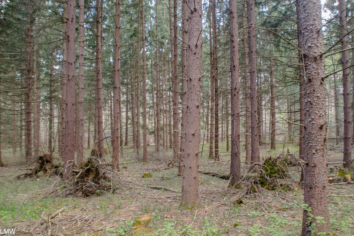
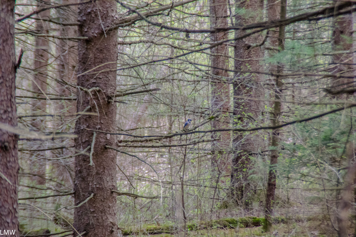
From the Skyway you can get a brief glimpse of Lake Michigan, which I always try to do. Wolf Lake’s industrial landscape tells a dramatic story from a geological perspective. The bus stopped in Gary, giving me a glimpse of City Methodist Church, a stunning gothic building now in ruins and returning to nature in its own climactic way. Things get nice and agricultural east of Gary, and I spent much of my time between bus stops looking for shapes in big, fluffy cumulus clouds. What little I saw of South Bend didn’t suggest it is quite the transit utopia the current transportation secretary would have you think it is, but admittedly, I didn’t get off the bus. By the time we stopped in Elkhart to stretch our legs, the sun was high in the sky and I was glad I put on sunscreen that morning.

The bus rolled into Fort Wayne around 4:30 p.m., a little later than scheduled, but not enough to irk me. I tucked my button-down behind the spot on my backpack where I’d clipped my bike helmet, and walked for about 10 minutes through south Downtown Fort Wayne. I rounded Parkview Field to Jefferson Avenue, I had to shield my eyes from the afternoon sun and as I walked to my Airbnb in the West Central neighborhood. My sister had arrived about 30 minutes before and we hugged for the first time since November 2019.

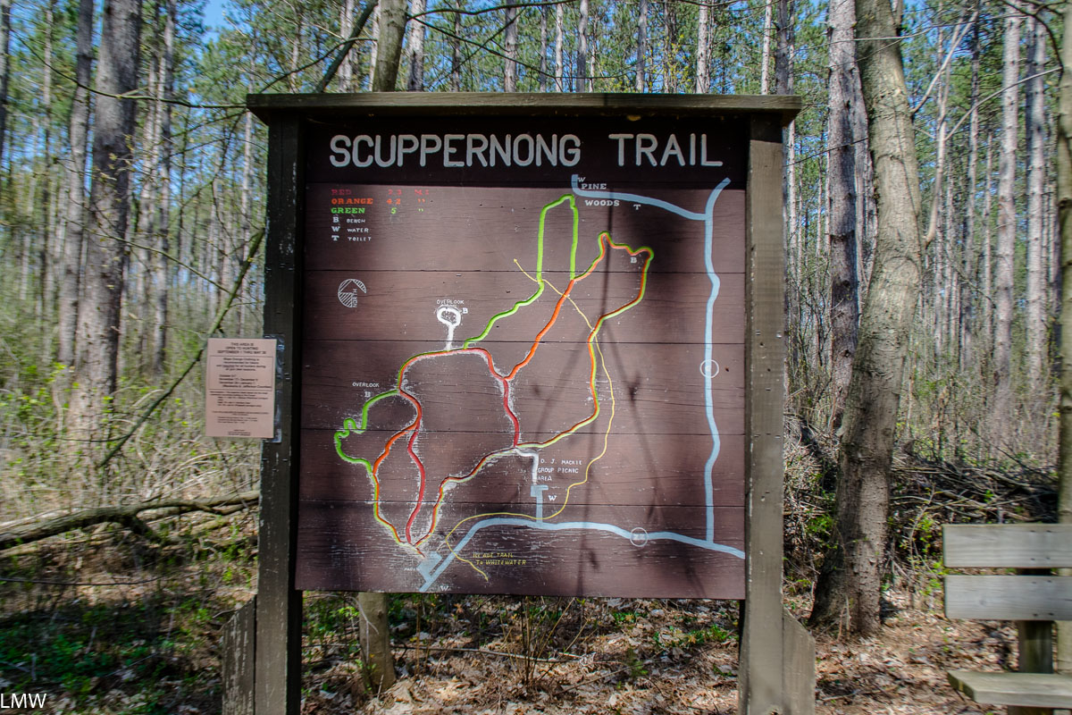
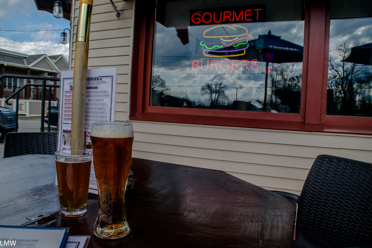
We first hiked up to Promenade Park, on the St. Joseph River. I learned that the residents of Fort Wayne call themselves Hoosiers and not Fort Wayniacs, but they come from every corner of the city to spend time here. It was about a 10-minute walk from our apartment to this stunning park, completed in 2019. Strolling past Adirondack chairs, we admire the beautiful native landscaping and modern sculpture. The amphitheater is elegantly designed to accommodate the river’s seasonal flooding, and everything in this park is accessible. Aubrey and I grabbed beers and pretzels from Trupple Brewing’s café in the building and enjoyed them in the beer garden. We texted an old friend, John Wagner, who lives in town about our plans to meet up the next day, before deciding to hike further into Downtown and try to find something to eat.

We strolled past a four-story-high mural of a bison and found ourselves at The Landing. The site of the first trade houses built in Fort Wayne in the mid-1800s, it’s now a pedestrian-only street with abundant restaurants, arts spaces, and patios. The street was mostly blocked off for a live band and beer tent, so we moved on towards The Deck at the Gas House. At the corner of Superior and Clinton, the former site of a now-defunct Amtrak station, we ran into our friend John, and his wife, Dani Wagner, biking towards their favorite vegan-friendly restaurant. Fort Wayne is a denser city than you would think, and its 120 miles of bike-friendly trails mean many people own a bike and use it to get around, even if they do still rely on a car for day-to-day commuting. We finalized our plans to meet up the next day and went on our separate ways.

We arrived at The Gas House, we learned that it was busy. The restaurant wait was long, so we went to the adjacent The Deck at The Gas House, where we watched kayakers paddle past while waiting for a seat to open up at the bar. The water in the river is muddy but relatively clean. European Americans founded Fort Wayne in the 17th century, in part, because it is the site where St. Joseph River, St. Mary’s River, and the Maumee River all converge. At every point in this city’s history its rivers, from trade to flood, were the main driver of change.

Across the river from The Deck at the Gas House is the Old Fort. The grounds are open to visitors every day with special programming occasionally. The original fort was built in 1815, less than a quarter-mile from where this replica now sits. The replica was reconstructed in the 1980s, as faithfully as possible to the original fort. Today, it’s sited on a beautiful campus adjacent to Headwaters Park. When I rolled in on my bicycle, the main fort was open and the barracks were full of soldiers in period clothes, eating sandwiches. The grounds are open at all times, but the buildings are only open during events. Admission is free but donations are welcome.

The lands that present-day Fort Wayne sits on are the ancestral lands of the Myaamia, Kaskaskia, Kiikaapoi (Kickapoo), and Bodéwadmiakiwen (Potawami) and Peoria tribes. The Miami tribe chose this site as the location of its capital city, and called it Kekionga. It was the central meeting and trading site for many decades, hosting official tribal councils and the large meeting house. When Europeans moved in, the Miami at first benefitted from trading with them. Europeans noted that this place was a short two-mile portage from the Little River, which connected to the Mississippi. The Miami continued to live at Kekikonga through British colonialism, the French-Indian War, and the American Revolution. During the Northwest Indian Wars, the United States Army burned villages and food stores but was forced to retreat after suffering high casualties at the hands of forces led by Little Turtle. In 1794 American General Anthony Wayne led his forces of well-trained former Revolutionaries through what we know today as Northwestern Indiana. Wayne wrote to a colleague during this time that his troops were “laying waste [to] the villages and corn-fields” of fleeing Native Americans. On September 17, 1794, Wayne personally chose Kekionga as the site for a new fort, which was named for him. In a speech at the Treaty of Greenville in 1795, Little Turtle called Kekionga “that glorious gate … through which all the good words of our chiefs had to pass from the north to the south, and from the east to the west.”

To the northwest of The Deck is Headwaters Park. By 1982, flooding was becoming without question A Problem in Fort Wayne, even then-President Ronald Reagan showed up to help sandbag Downtown after flooding made national news. The Headwaters Park Flood Control Project set out to find an environmentally sound solution for what was an inevitable annual problem. Businesses were removed from the flood-prone area, in a “thumb” of the St. Mary’s River. By 1985 flood damage in the “thumb” alone was estimated at $3.9 million ($9,922,755.82 in 2021 dollars) and represented half the flood damage in Fort Wayne that year. Today, native plants and wildlife flourish here, and 600,000 people visit each year. This sort of forward-thinking project is exactly what we should replicate all over the U.S. to help curb climate change.

The next morning I grabbed my first Veo Bike. The local bike share program is easy to use, and scooters are more popular than bikes. Riders download the Veo app, input credit or debit card information, and scan an available, dockless, bike or scooter to unlock it. Bikes cost $1 to unlock and 5 cents per minute to ride. My longest ride was about 35 minutes and cost about $3. Scooters cost $1 to unlock and 25 cents per minute to use. End the ride by locking the bike’s rear wheel, and following logging the end in the app. Aubrey was able to bring her personal bike, so when we met up with John the next morning at the Fort Wayne Farmers Market’s, she spent a few minutes locking her bike to one of the city’s ample bike racks, but I was able to just put up a kickstand, lock its wheel, and walk away.

There are over 60 vendors at the Fort Wayne Farmers Market. It’s attended by thousands of people each week. It is held from 9 a.m. to 1 p.m. on Saturdays and 3 p.m. – 7 p.m. on Wednesdays. I had a GK cherry hand pie. It was flaky, crisp, and buttery without leaving my hands feeling greasy. The cherry was bright and sweet without being cloying or saccharine. From the market, we went to Collective Coffee, which faces Headwaters Park from the southeast side of the St. Joseph river. I had a cold brew black coffee there, it was served in a pint glass and at first, I assumed it was someone else’s because the nitro process made it look like a freshly poured Guinness. I happily drank it in the bright, airy space underneath the potted tree in the converted warehouse space.

Feeling caffeinated and fueled, we started the big bike adventure part of our day. John Wanger, in addition to being an old friend from my hometown in Central Illinois, is currently a photographer at Fort Wayne’s NBC affiliate. This year he was nominated for an Emmy for his work reporting on the protests surrounding the murder of George Floyd at the hands of a white Minneapolis police officer. When John moved to Fort Wayne from Los Angeles he quickly realized that he loved the community, history, arts scene, trails, and transit options he found there. He graciously spent the day giving us a tour of the best Fort Wayne had to offer.

First, we rode, with me trailing on my sturdy Veo, to Fort Wayne Outfitters at Promenade Park, where I rented a Scott Bike. Four hours and a bike lock cost $33. My own bike at home is a little beat up, and a bike share bike is about comparable in terms of brake responsiveness to my own bike, so I am in the habit of jamming on my bike’s brakes to get it to slow down. At first, the Scott’s sensitive disc brakes nearly sent me over the handlebars, but I managed to keep it upright.

From there we rode onto the River Greenway. The River Greenway is 25 miles long, and as we peddled we saw public art on a permission wall, where talented spray paint artists use the space as a rotating, self-regulating art exhibit. We also rode past Lawton Skate Park, a 20,000 square foot park where Tony Hawk once showed up, unannounced, as part of his American Wasteland Secret Skatepark Tour in 2005. The park’s flowing design gave the legendary skateboarder the chance to do tricks and stunts he wasn’t able to do anywhere else on the tour.

From the Rivergreenway, we hopped on the Spur Trail, a sweet, leisurely ride along the very edge of the river, which lead us to our destination, Johnny Appleseed Park. In 1845 John Chapman arrived in Fort Wayne. In his lifetime, John had already become an American legend. He was better known then, and to this day, as Johnny Appleseed. He traveled the United States planting apple tree nurseries and leaving them in the care of a neighbor who sold trees on shares. Johnny returned every year or two to tend to the nurseries, so the popular image of him planting seeds all over the continent isn’t far off. He planted 15,000 trees within the 42-acres he maintained in Fort Wayne. He was known around the city and lived here until he was 70 years old. He was buried in the cemetery on the farm of some friends, and Hoosiers have cared for his grave ever since. I wanted to visit the final resting place of this American legend.

Johnny Appleseed’s Gravesite is a thoughtfully maintained plot of land, that Chapman would probably approve of. The simple grave is covered with rocks and surrounded by a short wrought-iron fence. The headstone reads “He lived for others.” The landscape is full of native plants, and decorative fruit trees, including apples and cherries. This meditative space really shows the affection Hoosiers have for this American legend.
Each fall Fort Wayne hosts the Johnny Appleseed Festival in this park, where thousands of people eat apple pies, drink cider, and celebrate the legacy of an American legend. Visitors who want to learn more about Chapman should visit the Fort Wayne History Museum, 302 E. Barry St., which has a permanent exhibit on his life, and time in the city. Today the park’s 31-acres include a campground, with key code-protected shower facilities, and Camp Canine, a members-only dog park.

Leaving the park, we hopped back on our bikes and took the Rivergreenway to the Junk Ditch Brewing Company, 1825 W. Main St. This James Beard-award nominated restaurant opened in 2015. Their blackberry gose is tart without hurting your cheeks, and more dry than sweet. Would recommend.
From Junk Ditch we rode on bike lanes, city streets, and sidewalks. Fort Wayne changed the law to allow cyclists to ride on sidewalks, but please be considerate of people who may be slower than you, or who have mobility concerns. While crossing a bridge over a river, with a railing to our right and traffic to our left, all three of us got off and walked our bikes to give room to a woman pushing a stroller, because anything less would be very dangerous. Please use consideration and caution while riding your bike on the sidewalk in Fort Wayne, and take bike lanes or trails whenever possible.

Our next stop, we visited the Fort Wayne Museum of Art, 311 E. Main. Though these two stops were on opposite ends of the same street, the Rivergreenway remains the best way to get around Fort Wayne’s central district without your car. It’s mostly separated from traffic and the landscape and public art keep it from being boring.

For $8 admission, we walked through eight galleries featuring works from notable African Americans, glass sculptors, historical Hoosiers, and two galleries full of works by early 19th-century artist Alphonse Mucha. This small, but dense, museum is thoughtfully laid out, with rotating exhibits from all around the world.

That night Aubs and I met up again with Dani and John and went to a TinCaps game at Parkview Field. Fort Wayne’s minor league baseball team draws a packed crowd all season long. We bought tickets 15 rows from third base for $14. The team name refers to the fabled tin pot that Johnny Appleseed was known to wear on his head as he wandered the country. Their logo is an apple wearing a cartoon tin cap. In the gift shop, I bought a t-shirt featuring a sub-brand of the logo they did, Manzanas Luchadoras. Because it is a luchador apple I mean come on. The home team lost that night, but the gameplay was taut for the last few innings.
