Most frequently, I can be fund on the NW side of Chicago, hiking in Ted Woods, backpacking around the Great Lakes, and walking my dog. Whenever possible, I try to ride my bike or take public transit.
This post concludes my 4-part series recapping my trip to Isle Royale National Park in September 2023.
9/8, 2:30 p.m., a picnic table at Rock Harbor.
We’re 1 ½ beers into our day. We ate lunch at the Greenstone Grill, rather than snack on what little nibbles we’ve got left. We are now well stocked on candy and books and a sixer of Keweenaw beer.
We got up this morning and skipped coffee. We got on the trail around 8:30 and were in Rock Harbor by noon. We are at Site 17, and it’s been a few hours so I do not know if we have neighbors in our campsite. Hopefully not, but I won’t be surprised if we do. Today the skies are sunny and bright. There are just a few clouds in the sky. The temperature is cool, but sunny spots make it all feel different. It feels very good to wash my hands. I mailed off postcards. The original four that I picked up in Houghton, and four more. To Aubs, Joe & Randi, Michael, Ryan and Dave’s parents. We have mashed potato dinner plans, and now all the candy you could want.
4:30 p.m. Site 17
The Ranger is here, but the hikers haven’t decamped yet. We’re expecting a melee when they do. Site 17 appears to be too small to share, so here’s hoping for our seclusion.
I hate to leave the island but I know that this is not a place that needs me even if I need it. We’ll be back, always.
5 p.m. Site 17, Rock Harbor
Candy, chips, and mashed potatoes for dinner. Also beer. The finest. I have started reading a new book from the shop. “National Parks and the Woman’s Voice: A History” by Polly Welts Kaufman. It’s the kind of book I like, with lots of citations and tiny print.
6:15 p.m. Camp
I suspect we may have a site all to ourselves tonight. Lucky us. The folks in the overflow site look cramped. We are well-provisioned with candy and chips. Mashed potato and chicken dinner tonight. The veg are gone. We put the last of the cheese in dinner.
Hike report: Real miles 21, mental miles, 23
9/9 9 a.m. Ranger III Passenger Lounge
Leaving the island this time is a little like leaving summer camp. Everyone is friendly and chatty and swapping stories. No one really knows anyone’s name and it doesn’t matter at all. I’ll miss the island. I always do. Dave got a breakfast burrito from the grill, but he thinks they forgot the potato and added more egg instead. There has to be 5-6 eggs in there. He’s not upset.
I took two chewable Dramamines so we will find out if it still zonks me out. I hope not because I want to stare at the island for as long as I can.
9:30 a.m. Ranger – Outside, facing the island
I think I have talked to about half the people on this boat in the last week. The Dramamine has not zonked me out yet and I just ate a muffin. I hope it will sit down and stay there. (It did.)
In the shelters – watch your head. Dave’s bonks |||, Lindsay’s ||
On the trail when your body runs out of fuel. Quick sugar.
In the shelter or a tent between two people who like each other very much.
Glad I had that
Packable jacket
Pashmina
Buff
Knitting project
Waterproof boots
Wish I had that
Gloves below 60 degrees F
Knit hat
More coffee, Esbits
More TP and hand sanitizer
Hot bullion drink
Potential next time hikes:
Washington Creek -> Hugginin -> Washington Creek -> N. Lake Desor ->Lil Todd -> Todd Harbor -> (Hatchet Lake? Or) McCargo Cove. If McCargoe, ferry out 36 miles, if Hatchet -> Greenstone to West Chickenbone, continue onto Rock Harbor.
Windigo -> McCargoe -> Ferry
Ferry -> Water Taxi -> Middle of the island -> Start hike
We’re moving on today. It did not rain, and there are no clouds in the sky. We’ve decided to head back to Daisy Farm and make our choices from there – skipping Lake Richie completely. The trail to here and Daisy Farm is all along the side of a rocky ridge, and frankly the idea of hiking those rocks while it’s slick makes me nervous. We may head to Lane Cove after that, or Three Mile so we can access the tourist boat to Edisen Fishery. We found an apple tree at Daisy Farm, which should really class up our dirtbag charcuterie. I saw the sunrise this morning.
12:20 p.m. Shelter 9, Daisy Farm
How did DF -> MB take three hours but MB -> DF only takes two? Isle Royale governs its own time and place.
This site is surrounded by thimbleberries. Some of which are still good to eat. There is an apple tree with tart, little green apples. I ate one sliced right off my knife, which feels correct. Dirtbag charcuterie today: Lemon blackberry Propel, pepper salami, cheddar, green apples and fruit leather.
A lady we met on the trail says the weather now only predicts rain on Wednesday, which if true, puts us in a good spot to ride it out.
Hike update: Real miles, 14. Mental miles, 17. My active outfit is getting dank.
Ovenbirds love Daisy Farm.
2:15 p.m., the beach at Daisy Farm
I have just learned that I have survived a forest fire. I watched a crew dressed in wildfire fighting gear leave in a ranger boat. The word around camp is at about 10 a.m. this morning, someone came to Daisy Farm and told everyone to stay put and off the Greenstone. Then two firefighting crews arrived about half an hour apart, docked, and marched right up. I guess the fire was at the Mt. Ojibway Fire Tower. Another person heard at Rock Harbor around 12:30 p.m. that the fire was already out. There’s still one ranger boat here, so I assume the crew is still cleaning up.
4:50 p.m.
I found a Greenstone! Dave has found several nice agates. This is a good rock-hounding beach.
5:25 p.m.
We are now skilled Greenstone hunters. After the first, we put on our greenstone-hunting eyes and have found 8 so far. Many little cannardlies. (As in you can-ardly see them.) We’ll probably stay here again tomorrow night. We plan to throw them all back one at a time and make wishes.
We’re hearing a loud rumbling coming in from the southeast and the sky is becoming overcast. We can see the cabin for the Wolf and Moose Study from our picnic table.
I can’t believe finding greenstones is so easy and so fun.
6:15 p.m.
A cool wind is blowing in from the south.
Dinner: Garlic mash, chicken, cheese, ghee and vegetables.
7 p.m.
Camp fox came sniffing around our dinner. The clicking of the camera scared him off. A second camp fox that came for dinner does not fear the camera.
8:20 p.m.
It gets darker here earlier than it does at Moskey Basin. No rain yet. I finished my socks on the dock so now I have to read my book. Knitting is handy for when you want to keep your hands busy, but still look at scenery. The thunder has moved west of us.
9/6 Shelter 9, 8:30 a.m.
The rain came in just after dark. A booming and thunderous storm that brought the wind to knock down branches, and lightning to backlight the trees while it did so. The thunder was low, loud and its deep rumbling sounded like it sat on top of us and bounced between the archipelago for hours. From the inside of the shelter, it was pretty romantic.
It rained all night. The morning’s sky is very overcast. I finally broke out my rain jacket for the first time this trip. We’re finally back on track according to our itinerary if we just stay here tonight. But between hunting greenstones, and possibly hiking up to Mt. Ojibway to see the aftermath of the fire, I think that is what we’re inclined to do today. There’s still wind, and the air is cooler. I’m glad we left Moskey yesterday, because I was not keen on hiking those rocks after a rain. If this concern is going to affect my hiking, I should probably get one of those GPS locaters for my person.
Our camp fox joined us for breakfast, one of them anyway. He’s a young guy with skinny little legs. He looks sad and damp. He doesn’t make the faces Dixie makes.
Noonish
We’re up to 19 Greenstones. I’m showing them to everyone. The air is misty today. The wind is high and the lake is turbulent. We’re spending the afternoon reading with our backs resting on the shelter and the wind in my hair.
Loons and songbirds each have a lot to say. Winter wrens, goldfinches, sparrows (very friendly), ovenbirds and orioles. According to the book I’m reading “The Crooked Tree, Indian Legends of Northern Michigan” by John C. Wright, the reason today’s weather changed so drastically is because Nanaboju and his brother are running a footrace nearby.
2:30 p.m.
Lazy day at camp. The weather is cooler, so we’ve budgeted dirtbag charcuterie to include a hot drink. Today was jasmine tea and honey, apples, fruit leather, 3-year Irish cheddar, pepper sausage and jerky. Fucking luxury. Why would you want a Mountain Hardware bag when that’s an option?
One a misty , cool afternoon, with the resonant lake lapping just 150 feet away. Our shelter faces the other side of a large thimbleberry, grass and pine. One skinny old pine cracked in the storm last night, and fell in a way that should not create any work for the park service, so it’s a nice redecorating moment. The lake is a little too turbulent for rock hunting right now.
3 p.m.
A rainy afternoon with just enough wind to make it pleasant. Today the sky is a flat grey, the trees on the islands in the water are misty, dark silhouettes. The lake is an uninviting blue grey. Today it is fall on Isle Royale.
Meals left:
3 dinner
2 lunch
2 snack
3 breakfasts
What we’re rationing:
3 chicken portions
1 fried Rice-a-Roni
1 baby red mash
1 chili seasoning packet
1 mac and cheese meal
1 bag of shells, just shells (noodles)
Meager amount of veg mix
1 meal of tomato sauce
7 granola bars
0 wine
½ sausage
2 slabs of fruit leather
8 pieces of jerky
½ brick of cheddar (3-4 oz)
4-6 oz of ghee
Electrolyte tabs: 24 regular, 15 caffeine
1 green tea
1 spice tea
2 cocoa packets
2 honey
4 starbursts
11 Esbit tabs
The rain drove us inside around 4:15 so we took stock of our supplies. We won’t starve before Rock Harbor but we are dangerously low on candy. The Sweet Tart Ropes are long gone. At 7 p.m. we’re going to hear the Wolf and Moose presentation. I’ll be a fangirl if Carolyn Peterson shows up.
While I have always preferred trail runners, I like boots for both grippiness and waterproofing. My feet haven’t been damp at all except when I wanted it.* The new socks I knit are my new sleep socks and they are indulgent. We are consuming the last of the wine. Soon it will be gone, to the realm of the cookies and the Sweet Tart Ropes.
*Excepting at Moskey Basin when I went in up to my socks.
Dinner: Fried rice, chicken, veg and ghee.
Dave saw a tiny grey mouse on the path while cooking dinner. It grabbed and nibbled at a head of grain before disappearing into the underbrush.
7 p.m. Presentation, Pavilion
Moose watch (100 skulls/week)
967 moose, 31 wolves
At least 3 litters this summer
19 new wolves came from four sources
5800 moose bones collected
Heat deadly for moose, can be more easily predated.
Balsam fir, alder to stain antler
Beaver population down, wolf pop. up
Stranger on a train – Describe how I feel here that encourages them to feel the way I feel here.
Ecstasy with adrenaline
8:45 p.m.
I just had a lovely conversation with Candy Peterson after her presentation. She pegged us as good candidates for Moose Watch.
9/7 8 a.m. Inside Shelter 9, Daisy Farm
The air is cold this morning. The kind of night where it’s easy to mummy down to sleep, and hard to mummy up in the morning. We’re spending one more night here and heading to Rock Harbor in the morning. Another long lazy, cool day. We’re rationing fuel picks, so I have to wait for Dave to wake up before coffee.
9:30 a.m.
We’re onto coffee. We may run out of coffee before we get to Rock Harbor but that’s okay. You can solve problems there with money. I heard a low, intermittent thumping sound at Moskey Basin a few nights ago. Dave didn’t hear it. But I learned at the presentation last night that it may have been a bull moose calling out for a cow. So, cool.
11:30 a.m.
We have found two more Greenstones. People keep walking past and I am subjecting them all to a small lecture about Greenstones. No regrets.
Today’s chores:
Top off water before bed ✔
Throw back greenstones ✔
Apples for tomorrow ✔
Pack lunch easy access for the hike ✔
The air is less windy today, but colder. I wish I had gloves and a hat. A ranger on the dock said things should improve by tomorrow. We’ll finish Dirtbag Charcuterie on the trail tomorrow.
Did I just see a yellow oriole?
Dave just noticed that the beavers have girdled all the aspen in camp. They’re working on a project.
3:30 p.m.
I have found nine more greenstones, bringing our current total to 33. They’re easiest to find in matrix and there are far more unpolished than polished. Dave is rubbing one against a sandstone rock to see if it will polish at all. Results: Inconclusive. We will toss them all back into the lake before bed tonight. They’re abundant in the little creek from the beaver dam.
The sky today is muted shades of grey. The trees aren’t hiding in mist anymore. The lake is cold, and the waves are unpredictable. I was hesitant about going near the shore this morning. I think Minong was pleased to see Greenstone hunter. They aren’t as common as they used to be. Minong went to all the trouble of making these beautiful little agates. We honor it by picking up the prettiest parts of it and tossing them back into the lake.
We treated all the water we need to treat for the rest of this trip.
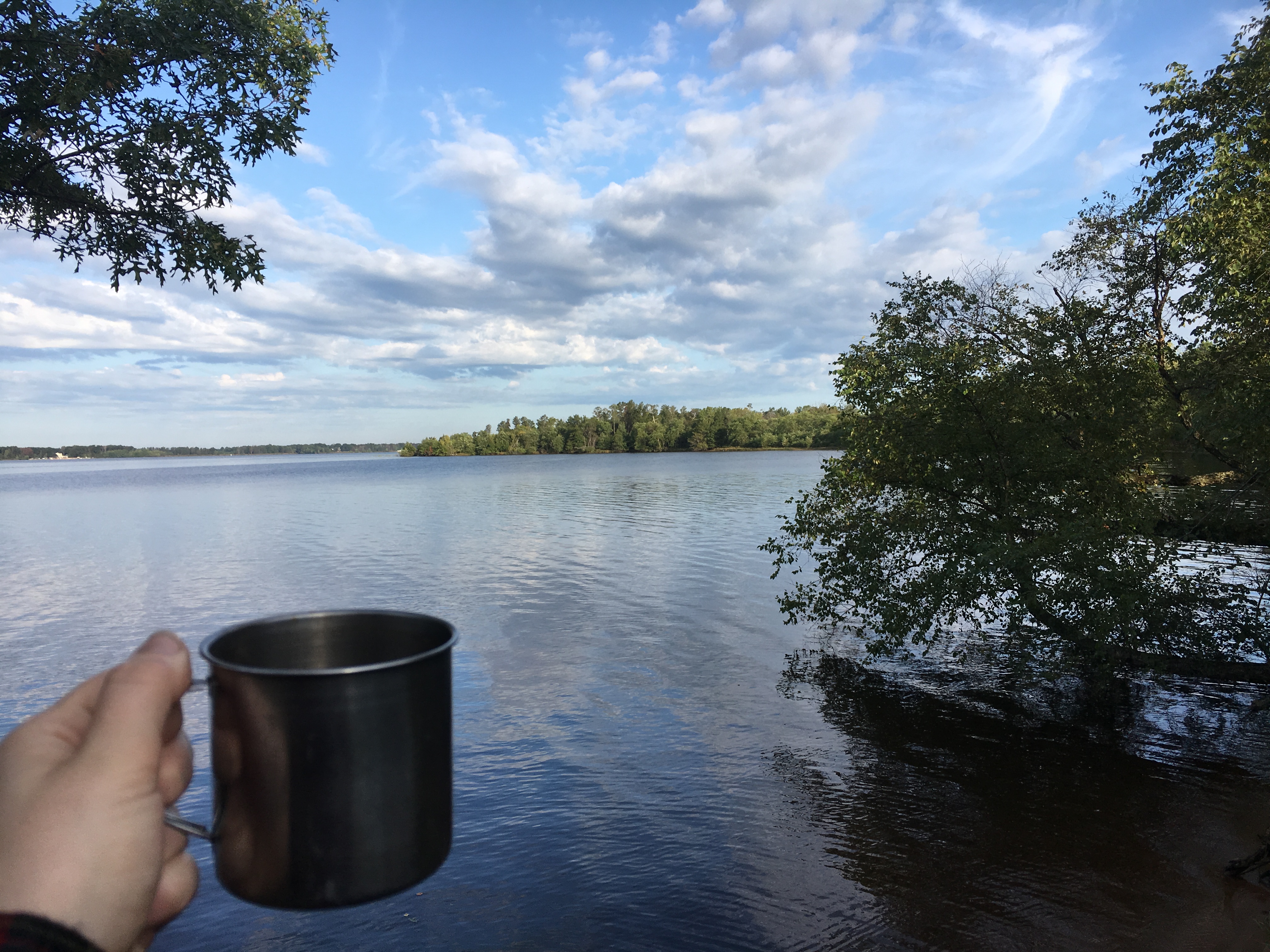
Update: Dave polished a rock. He’s exposing a beautiful turtleback pattern. Someone on the dock told me that the Ranger III left an hour early yesterday to avoid weather, so that may happen again Saturday. We hope to be in Rock Harbor by noon tomorrow. It will be heavenly if I get a hot cup of coffee in my hands.
I think the landscape over the last two days has changed to include more reds and golds than it had just a few days ago.
6:15 p.m. Site 9
We just saw beavers! Up close and munching on bark.
Dinner success: Chili mac: Chicken veg mix, tomato leather, chili seasoning packet (about half), Kraft dinner.
8:30 p.m.
Time for bed. The sky cleared up a little towards evening so the wind and lake are calmer. We’re hiking out early tomorrow morning. By 8:30 or so. We’re headed to Rock Harbor and since we’re so low on provisions, we’re both jazzed to visit a civilized town, such as it is. We’re hoping to be there by noon. We may go to the Greenstone for lunch because DBC looks sparse for tomorrow. What’s left of the food bag is practically adorable.
The moon was so bright last night, the stars didn’t show much. Coffee and granola. I am going to hike strong today.
11:30 a.m., a shady spot at Daisy Farm
It’s good we didn’t try to press on last night. I’m hiking strong today, but I’d have been flirting with disaster otherwise. Dirtbag charcuterie by the dock. Perfect weather.
3 p.m., Overflow Camp at Moskey Basin
We saw TWO WOLVES at 2:30 p.m. on the trail! Slinking through the woods away from the water. A dark grey one and a lighter color one. The campers here watched them chase a moose into the water.
Sorry for yelling, but not really. I’d show you photos of the wolves, but I was too concerned about not being predated.
4 p.m. on a rock by the dock
The leaves are not yet turning on the island. Isle Royale is already in Kodachrome. The water is cold, but I can keep my feet in for a few minutes at a time. Maybe I’ll be able to swim. Bright clear skies and warm air. Plus we saw TWO WOLVES. Dave is wading carefully.
5 p.m., camp again
Seeing two wolves was cool as fucking fuck. Now we get to make a wolf report. Also at the camp at Three Mile this morning, an all-black fox – save for the white tip of his tail – slunk through our campsite hunting grasshoppers.
Hike report!
Three Mile to Daisy Farm is a delight. Daisy Farm to Moskey is technically four miles. Mentally, it is six miles. The total distance so far is 2.7 to Three Mile, plus 8.3, so 11 miles. Mentally those miles were 13 miles. So 11 real miles, and 13 mental ones. We have campmates again. Four twenty-somethings from Minneapolis. They’re very funny. They’re all trying to see who can spin on someone’s little folding stool more than twice. No one has done it yet. Hilarious.
5:45 p.m.
We have two new campmates. A couple from Hyde Park.
8:30 p.m. Camp
The trails and forest floor are still vibrantly green. The lichens and moss on the basalt is every verdant shade. Asters are in bloom and line the trail to camp. I ate two thimbleberries today, tart enough to feel in my cheeks. We watched the water after sunset. No clouds to speak of. Good breeze. Horseflies by the lake.
9/3 8 a.m. Shelter 4, Moskey B.
The first thing we did this morning was to loosely pack all of our stuff and move it to an open shelter. Now we’re making coffee. The water access is easy and beautiful. We got up and went to the dock rocky overlook around 10 p.m. because we heard the northern lights were out. We nearly missed them because a heavy orange moon had risen low over the eastern horizon. It was stunning, but I hope we see the auroras tonight. (Dear Reader, we did not.) We had a gentle rain pass over us last night it was not predicted. The clouds are pretty much gone again by this morning. Finally heard a loon!
Today’s chores:
Eat Sausage ✔
Drink wine ✔
Fix backpack – Later, thanks
Swim? Wade ✔
Move to shelter ✔
11:30 a.m. Shelter 4
We waded in the water, and then had lunch. Dirtbag charcuterie this time consists of salami, cheddar, fruit leather, candy and cookies. Dave is cooling the wine in the lake for later. I finished knitting one sock, and started knitting a second. If it gets colder later in the week, I’ll be cozy af. Today is going to be a long lazy day at camp.
2:30 p.m. Near the Dock, in the only shady place we could find
No one is certain if they want to hike to Lake Richie and back tomorrow. We’ve been intermittently soaking in the lake and doing very little. In the heat of the day this place is very sunny everywhere. I stepped wrong coming out of the shelter (boots on) and kind of wanged my right ankle. I think it’s nothing, or something mild, but I’ll monitor it.
6 p.m. Shelter four
We’re both vibing on the site, and there is no rush to leave. We may stay another night. And the one after that. We spent a good chunk of the afternoon with our feet in the lake. Cool. High wispy, puffy clouds over camp this evening. Hot day, sunny.
Tonight’s dinner: Rehydrated chicken, rehydrated tomato-cheese sauce, yellow rice, corn and beans. Recipe: Soak chicken for 1 hour with tomato leather. Cook chicken and tomato for one Esbit pick. Add veggies, boil until Esbit is done. Put broth into one bowl, and chicken into another bowl. Cook the ‘ronis, up to two Esbits in broth for flavor. Divide chicken into two bowls, add cooked ‘ronis and veg. Mix with ghee for flavor. Fucking delicious.
Buggier by the water. I’m going to swab down and put on pants.
Boot got wet getting water :(.
Wolf Report
On 9/2/2023 around 2:30 p.m. we were rounding the trail to Moskey Basin from Daisy Farm. On the last low crossing before the boardwalk to camp, heading up, we spied two wolves slinking through the forest, away from the direction of camp. They traveled perpendicular to the trail. They were about 100 feet in front of us. The one in front was lighter in color, the one at the back had darker fur. I never expected to see a wolf on the island, so initially I thought it might be someone on all fours for some reason. I stopped in my tracks, pointed and whispered to my husband “Wolf. Wolf. Wolf.” To be sure he knew. The wolves hesitated briefly – I assume they heard us. But they continued on and were quickly out of our sight.
At camp we learned that the people on the dock had watched these two wolves chase a moose into the water, and the wolves slunk back into the forest, where I must have seen them.
9/4 8:30 a.m., Shelter 4, Moskey
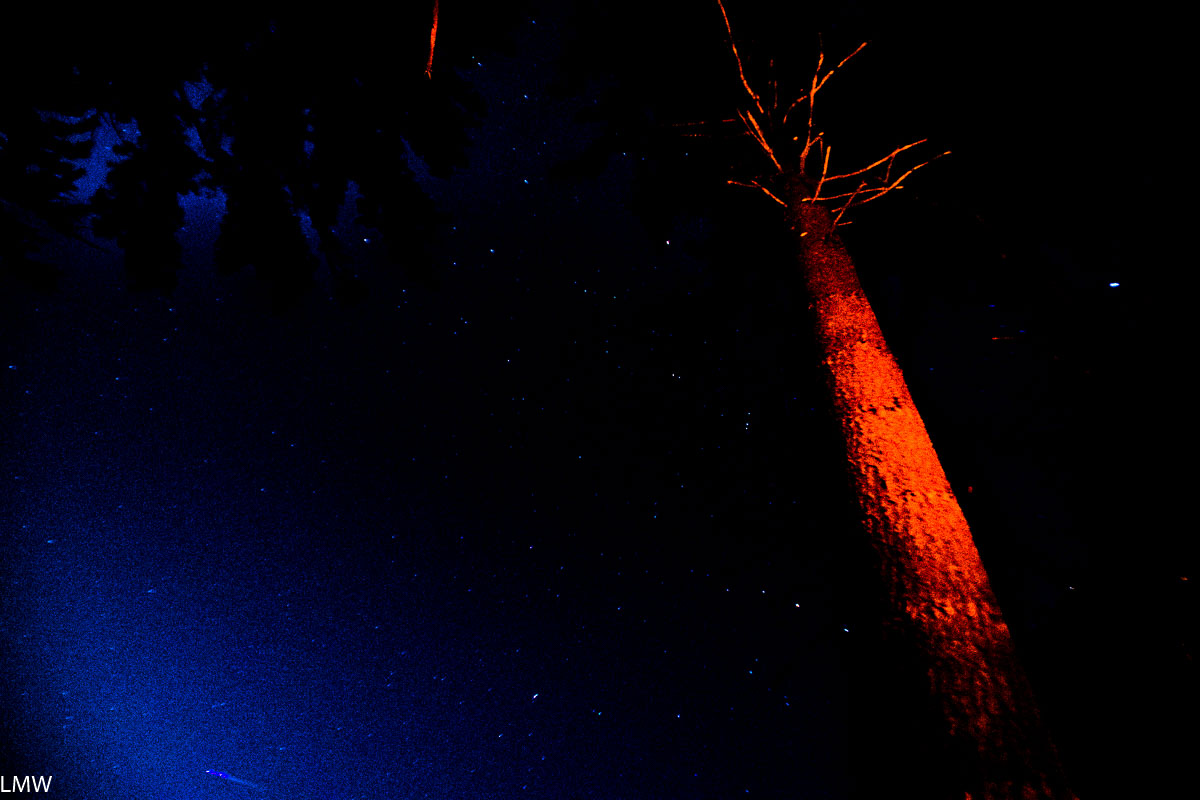
No one is moving quickly, not in my camp anyway. We’re staying one more day, hiking to Lake Richie, then back here for one night, then Daisy Farm and Rock Harbor. It looks like the rest of camp is leaving, so we should have a quiet day. My ankle feels fine. My boot is going to spend the day in direct sunlight. I stayed up after sunset watching the stars pop out of the darkness. I could feel the pulse of the island in my hands as they rested on the bare rock. I crawled into bed around 10 and fell asleep instantly. No aurora, but I saw the depths of the night sky until a bright waning moon rose, and the gentle lapping sounds of the water meeting the 1.5 billion-year-old basalt slab that held me.
If I were going to give a piece of advice to the shelter graffiti artists, it would be that I wish haikus were harder so you guys had to think it through, and not just mash syllables together.
Today’s chores:
Mentally prepare to go to Richie ✔
Fix pack ✔
Soak in the lake during the heat of the day ✔
Eat sausage ✔
Dry boot as much as possible ✔
Pack tent ✔
Trash update: the trekking pole basket Dave found fits on my pole. I think I lost mine here in 2021, so the island has given me a replacement.
Tomato sauce leather in yellow rice is a game changing development. Such flavor!
Mid-Morning sometime
I fixed my pack! A seam near the zipper was coming undone, so I sewed the fucking fuck out of it and reinforced it with grosgrain ribbon. A grasshopper that is missing one of its hopping legs is laying eggs in the dirt on the rock by our shelter. She seems totally unconcerned with me. She’s focused on digging her hind end into the shallow dirt on the rock by the water. In May, we’ve only seen teeny tiny grasshoppers on young thimbleberry leaves at Lake Desor S. I wonder if this is her last day?
Noonish
High wispy clouds. Changing weather? Our grasshopper gal pal has expired after laying egg catches for a few hours. Kind of a beautiful life cycle moment. I hope her nymphs are strong and healthy.
3 p.m. Shelter 4
We have lazed about all day. This is a nice place to be married and in love.
The weather is cooler today, but still hot and sunny. More clouds than yesterday. The shelter is staying cooler than it did yesterday, so we haven’t wandered far from camp. Ate all the Sweet Tart Ropes. I have turned the heel on my second sock. Dave has finished Clive Barker’s “The Hellbound Heart” and has moved on to Charles Portis’ “True Grit.”
5:30 p.m. Shelter 4
Dave is making dinner. Once the sun was behind a cloud, I was able to spend a few hours watching the clouds pass over Moskey Basin. Bright puffers, traveling west to east, midway in the atmosphere. Some of them have shadowy bellies, but none look like storm clouds. Dave and I each felt a single drip, we aren’t concerned. The air is cooler. I watched a second grasshopper lay eggs in the dirt on the rock. I think it’s important when you’re on Isle Royale to dedicate a few hours to staring at the sky.
An older man has swum out to the middle of the water. Good for him.
I haven’t seen a camp fox here, but we do have a nosy camp squirrel. Dragonflies are hatching from our shoreline.
6:30 p.m.
The loons are singing many verses tonight. They’re calling from other sides of the lake now. At least three spots, maybe more. The loon’s symphony lasted a full 9 minutes. A wonderful sound to knit to. About halfway up the second cuff. These socks are much taller than I expected. They fit well.
Dinner: Chicken, taco Rice-a-Roni, corn, beans, cheese, ghee. It was voluminous.
Update: There is a camp fox. Dave snuck up on him, as he was sneaking up on me. He was about eight feet behind me, but I didn’t know until Dave showed up.
8 p.m.
High, wispy clouds. Tea with honey after dinner.
9 p.m.-ish
I think the weather is changing. The wind picked up after sunset. Zero percent surprised if we get rain tonight.
Dear reader, in September 2023 my husband Dave and I took our third trip to Isle Royale National Park. These posts are a record of my trip, and almost directly transcribed from the little notebook I carried with me. Anything in italics is a note from Present Me, who finally got around to posting these in March 2024.
Weather Prediction
Date H L Sunrise Sunset
9/1 74 37 7:13 a.m. 8:36 p.m.
9/2 82 64 7:14 a.m. 8:34 p.m.
9/3 83 63 7:15 a.m. 8:32 p.m.
9/4 78 64 7:17 a.m. 8:30 p.m.
9/5 79 60 7:18 a.m. 8:28 p.m.
9/6 66 54 7:19 a.m. 8:26 p.m.
9/7 62 54* 7:21 a.m. 8:24 p.m.
9/8 64* 55* 7:22 a.m. 8:22 p.m.
9/9 63* 54* 7:27 a.m. 8:20 p.m.
*=Not NOAA
9/1 – 8 a.m. Ranger III – Houghton
9/9 – Ranger III – Rock Harbor
No rain in the forecast, but gusty winds. May be rainy or cloudy after the 7th. (Tuesday & Wednesday.)
Note: It did, in fact, rain. It went from the last hot days of summer to proper fall overnight.
Rock Harbor 9/8 – Stay
9/9 Depart 9 a.m.
Weather Report
9/1 Accurate
9/2 Accurate, HOT
9/3 Rain at night, day sunny, hot, accurate
9/4 Accurate, partly sunny
9/5 Accurate, sunny day, t-storm at dark
9/6 Windy RAINY, Cool, Accurate
9/7 Cool, breezy, humic, clear, wind p.m.
9/8 Sunny, cool, accurate, no breeze
9/9 No entry, probably accurate.
What Litter We Packed Out:
• Camp soap on a rope
• Broken glass bottle (old)
• Trekking pole basket (Replacement for mine!)
• Baby Hulk sticker
• Knot of embroidery floss
• Fishing lure, snap swivel
• Piece of plastic bag
• Pieces of glass (small) |||||||| ||
• Someone else’s hair tie (ew.)
• Piece of clear, hard plastic
Oops don’t do that again
Things to do to improve your next visit
• Factor in how seasickness affects your hike.
• Take off quickly from boat, pack to go before boat
• Toothpaste tabs storage options
• Do not let lotion bar melt in the sun
• Hot pepper/hot sauce
• Get another Osprey bladder
• Camera, lighter, 18-300 mm lens, night photos, longer battery
• Magnet for dock fishing (1-5 pound pull)
• Separate corn and beans
• Ghee tub in Ziploc
• More tomato sauce leather, a lot
• Buff for Dave, neck and hair
• Alternative (???) options Mainland Me does not know what this means.
• Better rain jacket for Lindsay
• More fuel always
Animals seen 2023:
Two wolves
Family of loons, hunting ||
Squirrels ထ
Mergansers ထ
Water snake |
Smol toads ထ
Gartner snake ထ
Egg-laying grasshoppers ||
Herons ||||
Beavers |||
Large woodpeckers |||| (Pileated woodpeckers!)
Small woodpeckers |||
Snails in the lake (12)
Bald Eagle
Black fox
Red fox |||| |
Friday, September 1, 20212
9 a.m. Ranger III Lounge
We’re just past the bridge. It’s a beautiful morning and I think warmer than when we’ve traveled in May. The tops of some trees are already showing their fall colors. My general nausea has been on high alert recently, so I’ve already put my little motion sickness bracelets on. The Ranger has replaced the puke bags with literal chicken take-out buckets.
4 qts per person, per day, of berries you can eat.
2 gallons of apples per person, per day
Poo 50 steps from water
Soap and dishwashing – 50 steps from water
1000 moose, 31 wolves
Foxes steal hiking boots
6 p.m. Three Mile Group Camp Site #2
We did not make it to Daisy Farm today. The water was not smooth and my motion sickness got gnarly. I didn’t get to eat any food on the boat. I spent about 5 hours hugging my chicken bucket and staring at the horizon. When we got to Rock Harbor, I went to the shop to eat whatever was around, which was chips and Skittles. So it made more sense to listen to my upset guts and not walk another four miles. All the folks at this campsite are also refugees and wayward hikers. They’re friendly.
7:45 p.m.
We’ve had dinner – rehydrated chicken and shells and cheese.
9:40 p.m.
The sun has set on Isle Royale for the first time for me. The stars are just coming out and I have already found Pegasus. I’m back in the tent (red headlamp.) We will hike to Moskey Basin tomorrow – 8.3 miles. Continuing today would have been a bad plan. I am glad we stopped. There’s a good breeze, and clear skies forecasted. I hope to stargaze properly at Moskey tomorrow.
Activities: Hunting, hiking, picnicking, trap range, archery range, camping, backpacking, cross country skiing, dog training, equestrian trails, geocaching, hunting, hiking, mountain biking, picnicking, and snowmobiling.
Reservations: The 27 class “C” sites in Pine Campground, are reservable. Group campsites can also be registered in advance. There are 12 primitive backcountry campsites along 55 miles of trail, they are reservable in advance but the trail is so lightly trafficked it shouldn’t matter much.
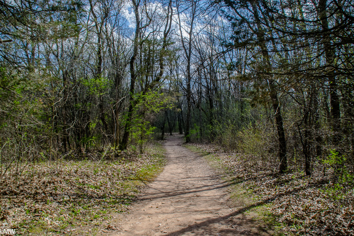
Pros: Quiet, beautiful, largely unoccupied by other people, tons of trails, prickly pear cactuses grow abundantly here. Turkeys are everywhere.
Cons: Water is not available on the trail. You have to cache your water in advance if you’re backpacking, as there is none available on the trail itself. The map is accurate, but don’t trust the scale.
This prickly pear cactus is native to Illinois.
Report:
Located just a little south of Peoria, Sand Ridge State Forest is not like any other corner of Illinois that you’re picturing. It’s basically a desert. The Illinois River flows a few miles west of the forest, but not one drop of drinking water is found outside of the big campgrounds. The water is there, supporting an entire evergreen forest and farmland, but it’s not above ground where you can drink it. There are points in the park you could dig as far as four feet down to get to the water source, and since that’s not in line with Leave No Trace Practices, you need to plan ahead. This means two things for the average backpacker: That you need to cache your water in advance; and that prickly pear cactuses grow here.
Native Illinois prickly pear cactus. Say it out loud, it’s a real thing. It’s not made up like unicorns, it’s real like narwhals.
The trail is made almost entirely of sand.
If we get into our Wayback Machine and go to late summer 2020, we will see that I had been stuck at home for about six months. My casually planned backpacking trips were cancelled suddenly, and against my will. So, like many of us, I stayed home. Watching the news, and the covid numbers, for months on end was both helping and not helping. By summer, I’d pretty much decided that Illinois’ response was about the best you could ask for, and our neighboring states were maybe mucking up a little much for my taste (sorry, Wisconsin.) The upside of this, was that it inspired me to stay within state lines, and get to know Illinois a little better.
Chicagoans, and I am guilty of this, have a tendency to default to Wisconsin or Michigan for our camping adventures, but Illinois is right here, waiting for us to go and explore it. When Labor Day rolled around, and I was firmly losing my mind, I picked the first proper backpacking trail I could find within state lines and went there, with a partially baked plan. Enter Sand Ridge State Forest.
BC3
The Yellow Trail at Sand Ridge State Forest is a 15-mile loop that goes through upland boreal and evergreen forests, and low farmland. The higher elevation is on the north end, and the lower elevation is on the south. Sand Ridge State Forest lives up to it’s name – prepare for sand. You don’t need to prepare for beaches, because there is no water, but sand is everywhere. The trails are sometimes wide fire lanes, and sometimes winding footpaths, but the one constant is sand. If you’re going to do this loop keep in mind that sand is an unstable thing to walk on. If you’re used to walking the well-worn paths on the Ice Age Trail, or trodding up and down the boardwalks at Starved Rock State Park, this trail will be far more work on your body. I wore a pair of trailrunners with a little, essentially, mud flap on the back and I think that worked in helping me hike that surface. If you’re hoping to speed through the trail, bear in mind that it’s a lot like walking on a soft beach in parts.
This would have been a much greater challenge for me had it not rained for two out of the three days I was on the trail. I’d complain, but the rain tamped the sand down and I think that made it easier to walk.
The map for Sand Ridge State Park is, technically, a good map. But is it a useful map? Sort of. It’s got a learning curve, I’ll say that. The park itself is bigger than the map suggests, and there are places where the map suggests the trail might not be as long as it is. The topography is not well communicated on the map. The Yellow Trail in particular is not well supported by park staff, which might be exactly what you’re looking for. The signage on the trail itself is good, if sparse. Wayfinding is accurate and clearly marked, but sometimes the only way to really “feel” like you’re headed in the right direction is by watching the campsite numbers change.
I lucked out and managed to speak (masked) face-to-face with park staff, a few minutes before I hit the trail and I made some logistical changes because of that conversation. Primarily, I decided against my plan to go counter-clockwise instead of clockwise. The trail is a two-way street, but you might want to navigate it clockwise because then it’s easier to cache water ahead of time, without doubling back too much.
I took a leisurely three days to do this trail. A more ambitious hiker could easily do it in one or two nights. You won’t find expansive dramatic vistas at Sand Ridge, but you will be able to watch insects and birds flit about fallow farm fields. You might hear woodpeckers hunting for grubs among the canopy. You might find the hawks riding air streams hunting for prey to be too majestic. You will probably get bored of seeing all these central Illinois native cactuses, because they are so abundant. If that’s not interesting enough for you, then I suggest you consider what your mind’s eye tells you is beautiful, and ask why it doesn’t include this little bit of Midwestern paradise.
BC3, shoes drying out front.
My route:
I parked on Pine Valley Drive, south of the Goofy Ridge blacktop. Pine Valley Drive is a gravel road, but there’s a little cutout for parking immediately south of the trail. I planned to stay at BC 1 the first night, BC3 the second night, and BC7 the last night. Before hitting the trail I’d stashed water at Bishop Road, and Sand Ridge Road. Water is available via a hand pump at Oak Camp, and I mean a big ol’ hand pump. Oak Camp is just a little ahead of BC1, so we topped up there before heading to camp.
BC1 is a lovely site. It’s narrow and long, which provides good privacy from the trail itself. It’s across from a game field, which was the site of a beautiful sunset and turkeys gobbling in the morning. Every site has a fire pit and tent pad, but no picnic tables and only a few overturned logs for seating.
The view from BC7 to the Yellow Trail.
Just after breaking camp the next morning, the skies opened up. The rain continued to fall for at least the next 24 hours straight. (That’s why I didn’t take many photos.) Once you’re rained on, there’s a point at which it stops mattering because you can’t get any wetter and I achieved that point just south of Sand Ridge Road on my way to BC3. I don’t mind hiking in the rain, because it tends to drive others away affording me more time alone in the woods. It also helps dampen sound, and changes animal behaviors. Nature is different in the rain.
BC3 was probably my favorite campsite. It was HUGE. I was camping with myself and my husband, but BC3 has space for at least two or three other tents without getting crowded. Honestly, the size of this camp was downright luxurious. That gave us a little space to hang things and hope to dry them out before moving on the next morning.
BC7 sits at the top of the steepest hill in the park. And its so, so long. This is the corner of the park where had I not spoken with park staff I would have done something supremely dumb. Initially, having never toted my own water to camp before, I thought I’d go counter clockwise, stay at BC7, and just double back carrying all that water. In my mind it made sense, because it looks like a smooth-ish trail, that can’t be too long, right? Wrong. I was wrong, don’t do that. The ascent from Sand Ridge Road to BC7 is steady, and consistently up. You want to do this stretch of the trail exactly once. If you stay at BC 7, do the trail clockwise and stash your water at Sand Ridge Road. If you want to do it counter-clockwise, stay at BC6, and stash your water at the same spot.
The view from near BC7.
BC7 was near the prettiest dang view I saw the whole time I was there. Fairy tales and fantasy adventure movies wish their settings were as pretty as this. BC7 is a bit closer to the trail itself. But this part of the park is also more remote. Mosquitoes weren’t a huge problem while I was there in early September, but that may have been in part because of the rain. By the time we got to BC7, the rain had passed, and being so high on the ridge lessened the number of bugs.
This was my first experience stashing water ahead of myself, and I think I did okay. It’s an odd experience when you’re normally a Midwestern backpacker because what we don’t have in topography, we make up for in abundant water sources. Because there were two of us hiking, we bought those big jugs of bottled water, and went through about a gallon each per day. Again, this was in early September, and it did rain on us so heat wasn’t a major factor. I’m not going to advise anyone to carry less water, because that advice can go south quickly, but do consider the weight of the water when you’re carrying it, and factor that into your pack weight. I literally just wrote my name on the jug in a sharpie marker, and left them a few hundred feet away from the road, a few dozen feet off the trail, hidden behind a tree where I would find them when I got that far. Try not to stash your water so other hikers have to see it as they pass, that kind of mucks up the natural character of the spot.
Packing in your water also means packing out your water. There were no trash cans anywhere on the trail, so I secured the empty jugs to my pack when hiking. It got to the point where I started to feel like the trash lady from The Labyrinth. Thankfully, the trail was not busy at all. I think in the three full days I spent there, I saw exactly two other people. A couple of fresh-faced day hikers, just as I was rounding the top of the hill by BC7. I think I was startled by their clean, unsunburnt faces just as much as they were by me, in all my dirtbag glory.
Guys, I’m not entirely sure I’ve ever properly introduced myself. My name is Lindsay Welbers and I’m a freelance writer living in Chicago’s Jefferson Park neighborhood. My husband and I moved up here in June 2019, after nine years living in the same apartment in Logan Square. We were attracted to the access this neighborhood had to public transit, I’m a 10-15 minute walk away from two Metra lines, the Blue Line, and a ton of CTA and Pace buses. Also, the forest preserves are up here and that’s as close as you can get to wilderness in the city of Chicago. White tailed deer screw up traffic about as often as the Metra does up here.
That’s what inspired me to write “Chicago Transit Hikes: A guide to getting out in nature without a car.” I was in a new place, and I wanted to know what natural spaces I could find. This book is a guide for anyone interested in getting out into nature, without the use of a car. All the hikes in this book are accessible from a train. I tried to make it as useful as possible for as many people as possible, so there should be something for everyone in this book. That includes families with little kids in strollers, people with mobility concerns, and people like myself who prefer a rugged and disconnected hike.
The differences in the natural landscapes of Logan Square
and Jefferson Park are subtle but clear. I knew how to find nature when I lived
in Logan Square, that was easy. I lived between Palmer Square, The 606 and Humboldt
Boulevard, so the natural world felt in many ways fully integrated into the
pace of my life. Those are all places I traveled through on my commute, and
they’re major pedestrian thoroughfares. They are vibrant natural spaces full of
people any day of the year.
Here in Jefferson Park, it’s a little different. In
Jefferson Park the nature lives in people’s yards, trees and forest preserves. You
have to step into the residential areas to find nature. There aren’t places
like Humboldt Boulevard to stroll, or The 606 to easily bike. Instead nature is
accessed from people’s backyards. The pace is slower and the natural landscape reflects
that. Palmer Square is full of sculptures and the occasional guerilla swing
set. Jefferson Park is full of gardens, lawns and most of the swing sets are
behind fences. That said it is gorgeous up here. My home office overlooks my
backyard and I probably saw a dozen different types of birds today alone. Also,
I’m pretty sure there’s an opossum living in my backyard. So I feel #Blessed
about that.
My very favorite way to really connect with nature is to backpack across what wilderness we were smart enough to keep that way, but I still live in the city. It’s where my friends are, it’s where I work, it’s where my husband works. I’ve lived my whole life in Illinois, and the entire time I’ve been exploring and trying to better understand our natural landscape. It helps to be able to walk in nature. There’s something about looking in 360 degrees and seeing nothing but oak trees and tallgrass prairies on all sides of you that acts as a salve for the too-connected world we live in. We all haven’t got the time, skills or desire that it takes to wander into the remote corners of the country, like I enjoy doing. There are a few campgrounds in this book, which make it pretty easy to immerse yourself in nature without having to travel too far. The rest of the hikes in this book are more like day hikes, so you can sleep in your own bed at night. Chicago sits at a place of unrivaled beauty in the Great Lakes region, my goal with this book was to show my neighbors how to see that beauty, using the transit system we already have.
Sterne’s Fen is on the right, the woods are the left.
Lately my car has been in the shop. That’s just as well, really, because my car is a nearly 26-year-old American muscle car with rear wheel drive. That means, it’s useless on snow and ice. I can usually get around without it, but when I need a car, I need a car. This time the brake lines gave out on me, so getting it fixed was a priority. Getting it back was not.
Wingate Prairie Nature Preserve
A few weeks ago, I wanted to get out and see
the fall colors. I’m really glad I did because a week later a wind storm blew
all the leaves off the trees and a week after that it was snowing. Fall was,
like, three weeks long this year. Lame.
A handsome goldfinch eating goldenrod seeds.
Since I didn’t want to fuss with my car, I
took advantage of my neighborhood’s robust transit system and took the Up-Northwest
Metra line to Crystal Lake. From there, it was a short 10-minute walk through a
cute residential neighborhood leading directly to Veteran’s Woods and Sterne’s
Woods & Fen.
The pond in front of the Nature Center.
VW and SW&F features beautiful hikes
through gently rolling hills, thick stands of oak, aspen and ash trees,
low-lying wetlands with grasses that are taller than you, and a vibrant prairie
filled with wildlife. The trailhead is directly next to the Crystal Lake
District Nature Center, and a short 10-minute walk from the Crystal Lake Metra
station.
This place is known for it’s glacial erratics.
The Nature Center should be the first stop for
any visitor to this park. Get a map, there are a lot of illegal, outdated or
deer paths in this park (especially in the prairie) and it can be easy to go
off the trail. Below the Nature Center is a pond, with a bridge path, and ancient
willow trees, but it can get quite mushy if the water is high.
Oh, aspens, you are so cute.
Veteran’s Acres is home to the Wingate
Prairie, which is a designated Illinois State Nature Preserve. Visiting the
Wingate Prairie gives a modern-day glimpse into what Illinois looked like
before the 19th Century and the invention of the steel plow. A previous
landowner tried to turn the area into a Christmas tree farm in the mid-20th
Century, as a result a stand of pines juts oddly from the center of the prairie.
The dense grasses native to the area are slowly reclaiming that land. Today,
the prairie is home to protected species of butterflies and plants that can’t
be found anywhere else on the planet.
A pair of goldfinches in Wingate Prairie.
Moving past Wingate Prairie and further into
the park, you will encounter a row of power lines running over a wide ribbon of
prairie. If you follow the path to the right, you can join up with the Des
Plaines River Bike Path, which will net you access to 56 miles of trail north
to Wisconsin. If you continue straight, underneath the power lines, you will
come to Sterne’s Woods and Fen.
Bellflower
Sterne’s Woods is
notably hillier than Veteran’s Acres. There is the steep slope of a moraine
between the woods and the fen. If the idea of ending your hike with a steep,
long, uphill hike that will have your hamstrings screaming sounds appealing to
you, take a right and follow the path through the woods and gently slope down
to the low-lying fen. As you return to the trailhead, you’ll come upon a quarter
mile march up a steep incline. If that does not sound appealing to you, take a
left and head down the hill first, letting gravity do the work for you. The
trail is a loop, so if you go either left or right you will follow the same
path and end back at this spot.
In case everything I said above didn’t make sense, here’s a map.
When you return, head back across the prairie
in the direction of Veteran’s Acres. This time choose a different path than the
one you came in on and take in a little more of the surrounding woods and
prairie. The trails all converge back at the entrance to Wingate Prairie, which
you passed on your way in. Visit during the late afternoon hours and you’ll
probably get to see tons of birds feeding on the seeds found among the prairie
grasses.
When you’re ready to leave the park, exit via the
trailhead near the visitor’s center, and return the way you came. There is no
shortage of cafes, shops, breweries and restaurants in the blocks around the
train station. Most days the train into Chicago runs about every hour, so it
isn’t the worst thing in the world if you miss it. Remember that the train
heading back into Chicago is on the opposite side of the tracks from where you
got off, so make sure you are where you need to be when it arrives.
Bridge paths throughout the pond area in front of the Nature Center.
That feeling of drinking hot coffee when all the air around you is about 52 tops.
I have wanted to go camping solo for a number of years. Suddenly, I had the time. My schedule opened up in an unexpected way and I made the decision to extend my time at Buckhorn State Park to stay a few nights by myself. I loved it immensely.
That feeling when you’re drinking cocoa at the end of a lovely day all by yourself when the air around you is back down to 52 again and it’s going to be dark in about 20 minutes.
I did not prepare to go camping solo in any way that was
notably different than how I would normally go camping, except for a few
things.
I kept my phone turned on and nearby at all times. Normally, the idea is to get as far away from 21st century communiques as possible, which means turning off your phone when you get to the trailhead and leaving it in your bag until you get back to the trailhead. I can get away with this because normally I’m out with my husband, and he keeps his phone on him throughout the trip. It felt like it would be irresponsible for me to completely disconnect myself, while also camping half a mile away from my car, in the middle of nowhere, where I am a strange lady camping by herself. Mostly I used it to watch the weather. I had daily check-ins with someone back in civilization so I was not quite as far off the grid as I would normally go.
My campsite was only .4 miles from my car. Car camping is straight-up more convenient than backpacking. There’s a reason that there are more car campers than backpackers. For one, you’ve got a mobile, fortified living room. The first night I was out there by myself storms rolled through just after dark. Wind gusts were north of 20 mph, and I was directly on a river so the force of water was a concern. I would be a liar if I didn’t tell you I was running over in my mind how quickly I could get to my car if I absolutely had to. (I never had to. It was great.)
I wore a big, scary, knife on my belt. Hello, I’m a somewhat short blonde woman camping by herself. It is my natural element and where I belong. I’ve spent a lot of time in my life alone in the woods and it is a deeply comfortable place to be. The trouble starts when other people don’t see things the same way that I do and might consider me to be a target, or equally bad, in need of assistance that I don’t need. Let me tell you, no one wants to chit chat with the woman wearing a big scary knife.
Number three may or may not have been necessary, to be honest.
My friend stayed with me at the site on Friday and Saturday nights. She left
around 10 a.m. Sunday morning and I don’t think I saw another soul for about 36
hours. I walked all over the rolling oak barrens where the hiking trails near the
South Campgrounds are and don’t think I saw anyone else until Monday afternoon.
The loud campers who had been staying at the adjacent sites went home on
Sunday, and the rain all day kept most (all?) day-hikers far away from where I
was. I wanted to be left alone in the woods, and by gum I got it.
Wild raspberries tho. <3
Rain most of Sunday kept me in my tent. I read and read and
read. I listened to the sounds of the rain on the tent. When it wasn’t raining
I walked and observed the fungi. I stared at the river as it gently rolled
past. I watched the clouds change shape and color and density. All of these
things took too much of my time and attention, so I didn’t even bother with a
campfire. Instead, I watched the sun set, and huddled back in my tent when storms
rolled through again that evening.
Backpacking dinner of packet chicken and broccoli chicken pasta side.
The storms were loud and wind was gusting above 20 miles per
hour. It did something similar the night before, but my friend was there with
me. This particular night, and this particular storm was my first solo night
out and I would be a liar if I said I wasn’t running through all the horror
movie scenarios in my head. What if that rustling outside wasn’t a raccoon,
but instead a murdering madman I hadn’t noticed all day for some reason. How quickly
could I run to the car from here? Could I carry anything or would it just be
best to bolt with the keys and my cell phone? Around 11 p.m. the rain stopped
and regular night sounds began. I fell asleep.
You know that spot where the open prairie abuts the forest? That’s the best spot.
Monday morning was glorious and bright, without a cloud in
the sky. The day’s temperatures probably peaked around 75 and the sun more or
less dried out everything in camp by that afternoon. If the rain Saturday and
Sunday kept crowds away, the work week caused them to disappear completely. I
hiked the remaining trails that I hadn’t yet visited on the south end of the
park. I was able to spot this handsome Bufo Americanus and had a brief commune
with a legless lizard. (A legless lizard, NOT a snake.)
A legless lizard! Not a snake!
I stopped in to speak with the rangers (to get help
identifying what I learned was a Common Woodcock that
had alighted in my camp the night before). This was probably the first person I
had seen since my friend left around 10 a.m. Sunday morning. Later I ran into two
day hikers on the trail. Basically, I went looking for a solo outdoors
adventure and I found one. I was able to explore miles of hiking trails,
shoreline, oak barrens and sand blows without running into another human. I
encountered legless lizards, toads, frogs, songbirds, grasshoppers, dragonflies
and whitetail deer without another ape for miles. I observed acorns fall from
branches and land on the ground, just to be carried off by a squirrel who will
either eat it or hide it and forget about it, allowing it to turn into an oak
tree. I remembered that it was the equinox as I watched the sun setting due
west. I read every page of every book I brought and fell asleep.
So that’s what the sun did at the equinox.
I genuinely think I sleep better on the ground, you guys.
On Tuesday I had a leisurely morning around camp. The sun
was out, and I hoped I could encourage some of the water to evaporate from the
rain fly before I packed up my tent (partial success). Truthfully, I probably
would have just stayed at Buckhorn a few more nights. I was rested for the for time
in what felt like a long time, refreshed, renewed by the sun and the rain. I
think sometimes you have to spend a few days outside just to hit the reset
button on your personal body clock. It’s good to realign it with the natural
light cycles. However, I was running low on food and I had read all of my
books. Also, I think my husband was starting to miss me.
Tons of rain all weekend. Learn to love it, or quit
Before I left I hiked the trails on the north end of the
park. This is where the fishing pond is stocked with fish and kids are
encouraged to cast a line. It’s also where the group campsites are found. There
are about 5 miles of hiking trails on the north end of the park, they make up
fully half the hiking trails within the park itself. You won’t hear me say a
nasty word about the pines or the gently rolling oaks on this end of the park,
but if seclusion and a landscape similar to natural Wisconsin, stick to the
southern end of the park.
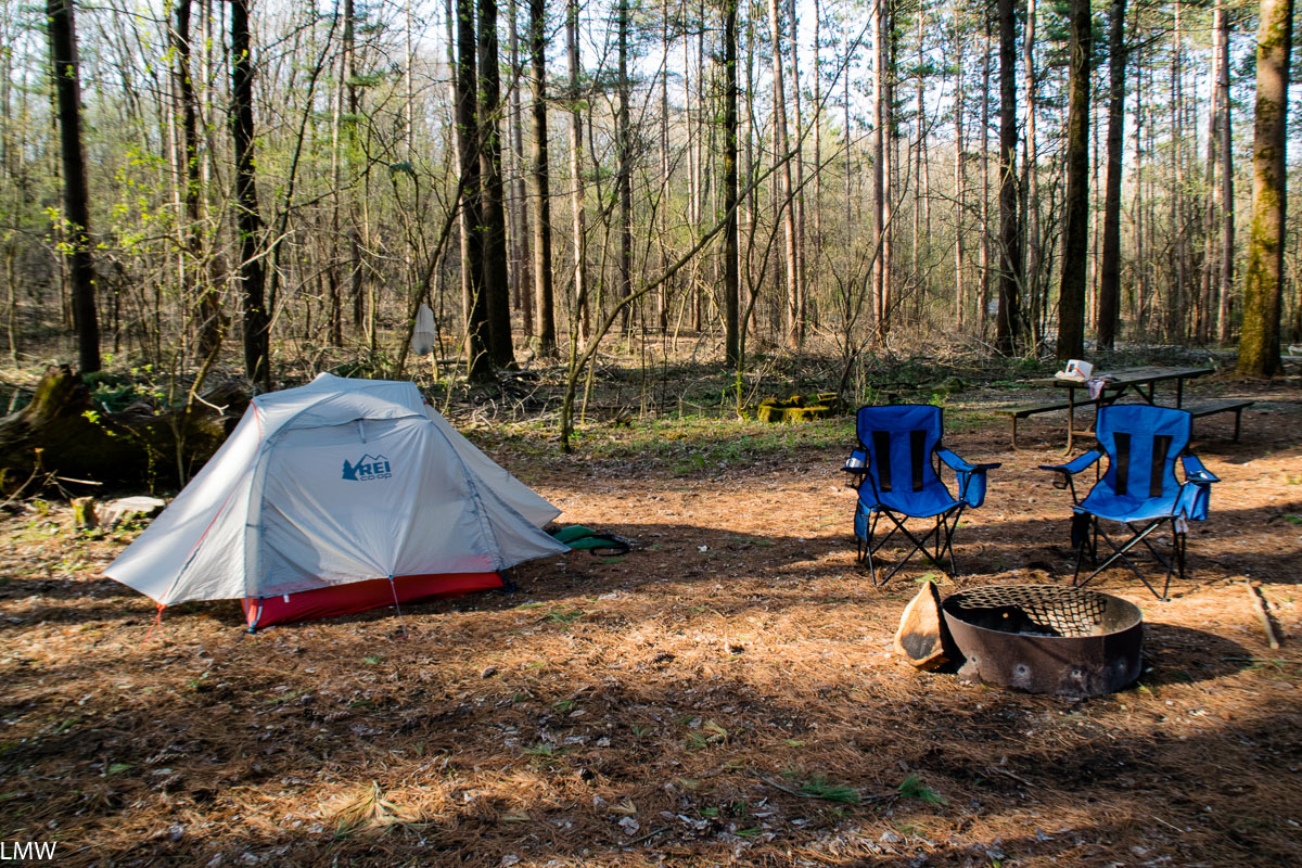
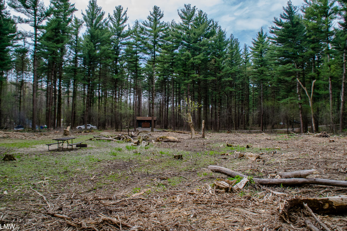
Site 15, where we moved after we saw Site 16 (eesh).
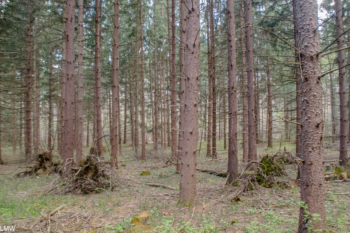
This year we’re planning to take our annual trip at Isle Royale National Park up in Lake Superior. There isn’t much in the way of new equipment that needed testing, but y’know it’s good practice to do that. For our test camp we spent one night up at Kettle Moraine Southern Unit just outside Dousman, Wisconsin. This is a stunningly beautiful piece of land that unfortunately has been marred recently by capitalism.
Site 16, which is allegedly a private hike-in site (except for the part where all the surrounding vegetation was logged away.)
Our trip overlapped with the Aquarids Meteor Shower and a new moon, so initially we were hoping to visit Green River Wildlife Conservation Area, which is a designated dark sky site. Unfortunately, rains all week led to floods and the staff there advised us to stay away. Seeking higher ground, which isn’t easy to find in this part of the Midwest, we headed up to Kettle Moraine. Green River is about 600 feet above sea level, Kettle Moraine gets a lofty 1300 feet above sea level. This is what we consider rugged topography in the Midwest.
Please enjoy this terrible shot of the night sky.
A Moraine is an accumulation of glacially formulated debris. Kettle Moraine stretches from Walworth County on the south to Kewaunee County on the north end. Extending over 120 miles of rough terrain, it’s a collection of irregular ridges and upland areas. It was formed when glacial sediment was deposited between the Green Bay and Lake Michigan Lobes between 18,000 and 15,000 years ago.
Elephant ears. <3
Since we booked our campsite only about 48 hours in advance, we didn’t do much research beforehand. There’s not a lot of huge variances in our topography around here, so I focused on where I could find the highest ground within about 100 miles of Chicago. We selected the Pinewoods Campground (because it’s designated as a 24 hour quiet zone and that matters to me so much) and chose the walk-in Site 16. Campers staying at the Pinewoods campground are asked to check in at the Ottawa Lake park headquarters.
This crow is probably thinking “Sqwak, where’s my habitat?”
We headed up to Pinewoods, found Site 16 and then just kind of stood there processing what we saw. Apparently on his way out of office former Wisconsin Governor Scott Walker felt he should do some redecorating across Kettle Moraine. Just about every tree surrounding what had previously been a hike-in site, was just gone. Logging at the campgrounds on this end of Kettle Moraine has done a number on the scenery, particularly the campgrounds on the north end of the Southern Unit. Hikers who take the green path of the Scuppernong Trail will get a pretty good view of the destruction. Apparently you need to bulldoze rows and rows of pine trees just to remove the ones they cut down. It doesn’t seem there was much rhyme or reason, and it was all done apparently for a little bit of money. I picked up bits of discarded truck tires, gas caps and other litter left behind in my campsite by some heavy machinery.
The view from the back of Site 16, looking back towards the main road through the campground. Cannot recommend.
We asked the camp hosts if anyone would mind if we stayed at Site 15 instead, and they allowed it. Site 15 was less damaged by the logging operations, and has shade remaining. Site 16, which had previously only been accessible after about a 200 foot hike away from your car, is now a full-sun site more or less all day. I cannot recommend Site 16 at this time. Site 15 is fine, if you don’t mind being adjacent to an open field where a bunch of pine trees used to be.
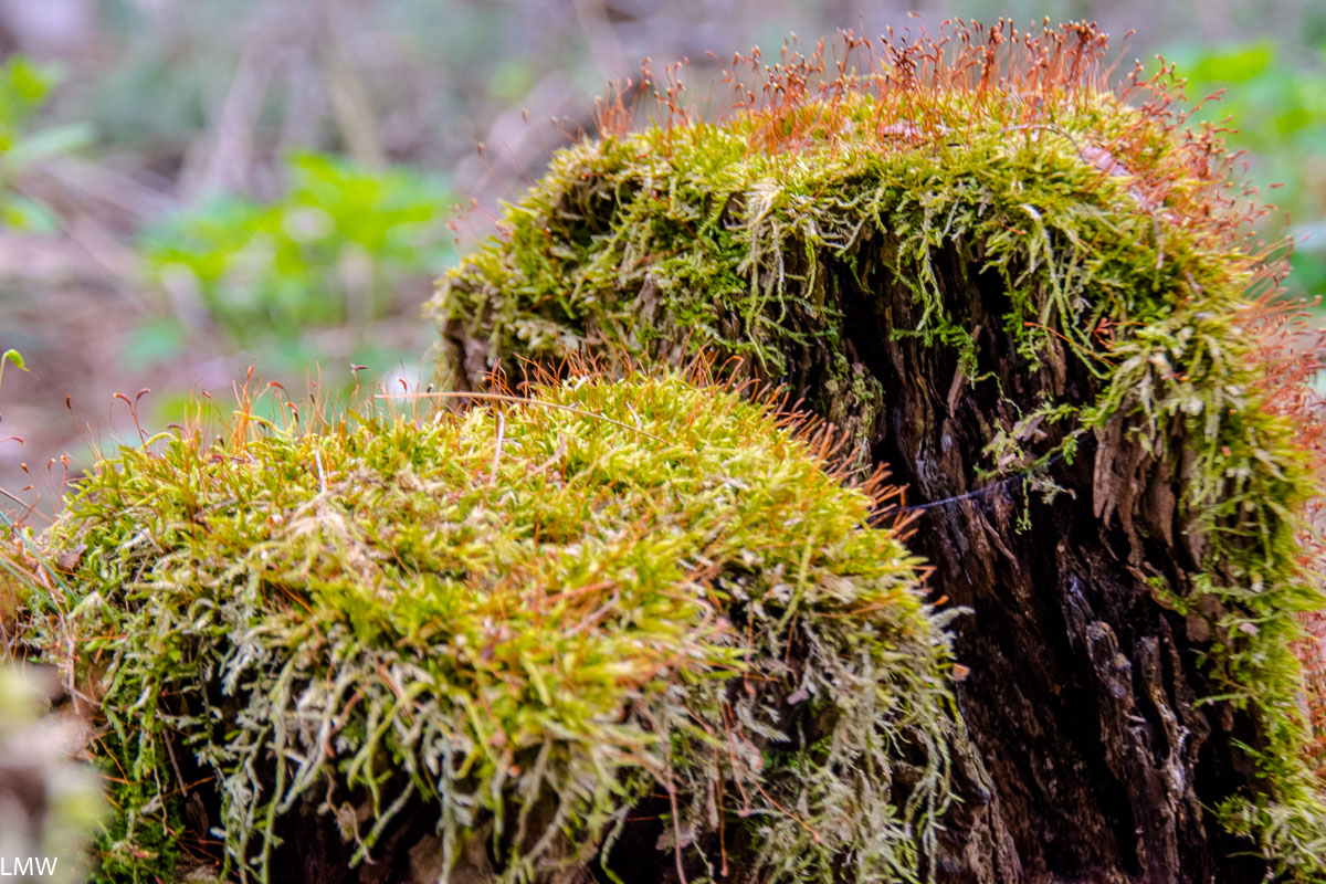
Mosses and spores, mosses and spores.
Sunday we got up and lazed about camp and made breakfast and putzed around looking at birds and mosses. This period was excellent. Dave took a leftover potato from the night before (baked in the fire, obviously), he made bacon and eggs and coffee. We broke camp maybe around noon and headed to the Scuppernong Trail Head, fully loaded with our packs.
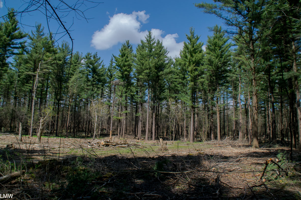
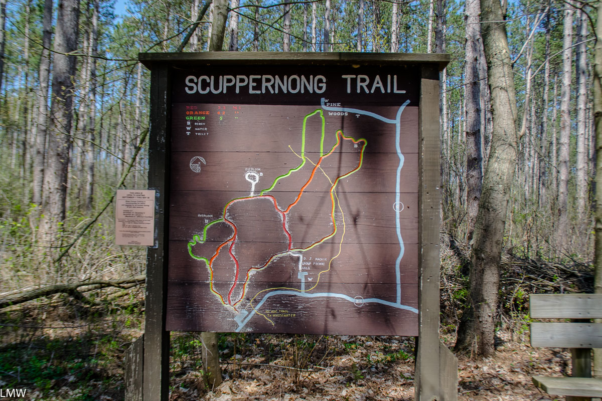
I’ve got zero beefs with the Scuppernong Trail though. Overall, it’s a beautiful and excellently marked path. It would be much improved if they left the trees alone along the north end instead of cutting them down for private profit.
The Scuppernong Trail System intersects with the Ice Age Trail and includes three shorter loops of varying difficulties, ranging from 2.3-4.9 miles in length. At the trailhead there is sufficient water, parking and a vault toilet. The trails meander through hardwoods and pines, including some truly gorgeous giants you’ll find at the end of the trail. Bikes are not allowed on this trail system, and in the winter it becomes a ski-only trail. I hope the Wisconsin DNR takes the time to very clearly mark the trail this winter, especially on the northern end of the Green and Yellow loops. The logging done on that end of the park has left wide scars across the land, and it’s pretty easy to see how a skier could easily get lost down a bulldozed path if the trail were not clearly marked.
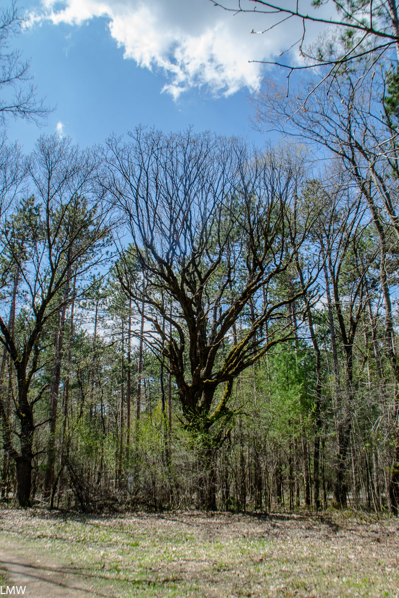
I”m a sucker for a big ol’ oak though. <3
Verdict: Kettle Moraine is a beautiful park, Pinewoods are a beautiful campground, avoid Site 16 and shame on Scott Walker. Shame shame shame, Scott Walker.
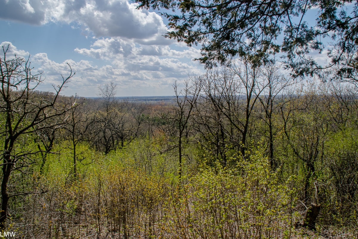
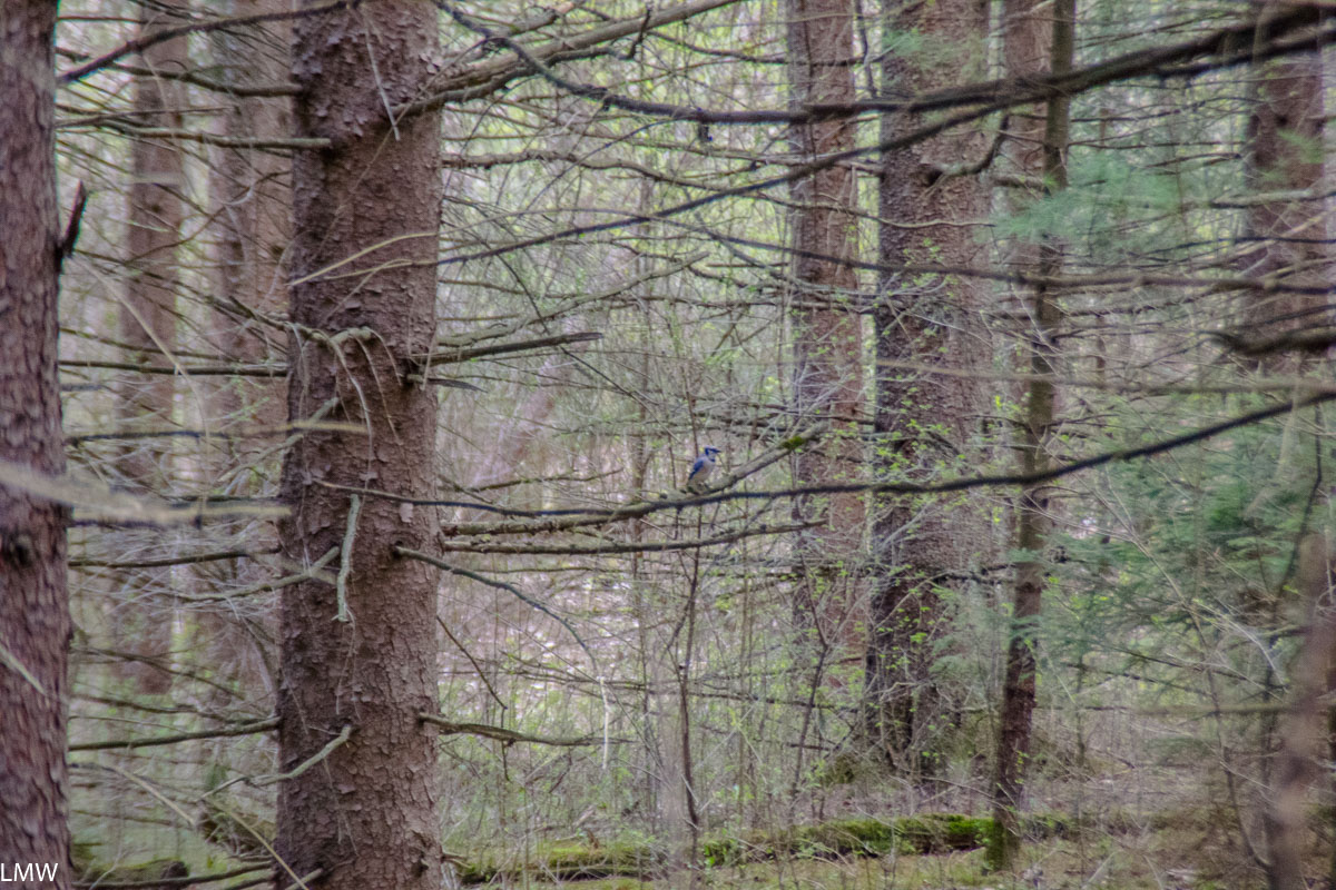
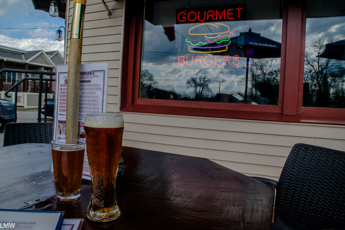
The view from Overlook Trail. The Scuppernong Trail is clearly marked and beautifully maintained. The waste left behind by the capitalist dogs that logged the Scuppernong Trail. This bluejay is probably thinking “Chirp chirp motherfucker what did you do with my habitat!”Yeah but then we got burgers and I drank a 22 oz beer.


