Camp Thunderbird Day 5: Ludington State Park

Ludington State Park
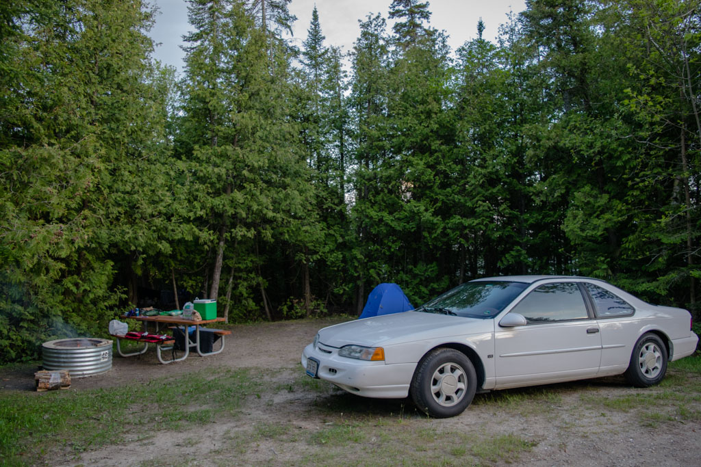
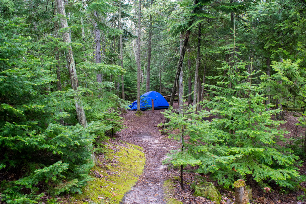
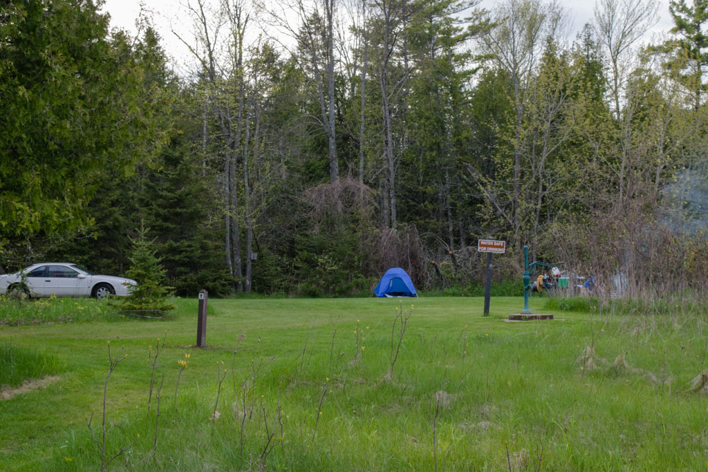
Where we stayed:
Jackpines – J, hike-in about one mile from the parking lot, fire pit, picnic table
Good for: Backpacking, backpacking-lite, couples, solitude
Not great for: Car camping, RVs
Pros: Fresh water available, if you buy firewood at the park they will bring it to your campsite for you, beautiful dunes and abundant wildlife
Cons: Raccoons, no restroom facilities
Website
Reservations

Day 5

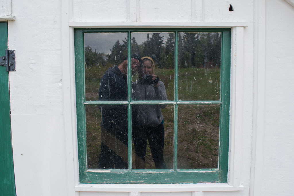
It’s funny how breaking down camp is different between backpacking and car camping. Either way, we had a pretty good incentive to pack everything into our backpacks but it seems to take longer if the car is there. Maybe I care less? Maybe we have access to more stuff that we wouldn’t bring if were backpacking (hello, Coleman folding seats.) I remember dawdling a lot that morning in Cheboygan during the breakdown phase, but I don’t remember what I was doing. There wasn’t a lot on the day’s agenda, it’s a 3.5 hour drive between Cheboygan and Ludington and neither of us felt inclined to rush.

_DSC0084 (1).jpg

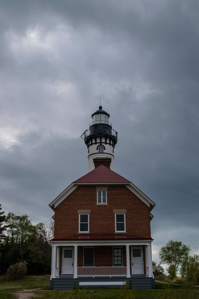
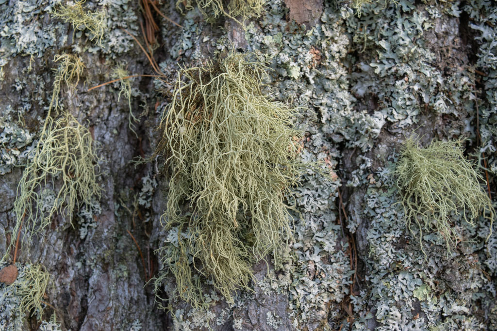
Ludington was a great place to end this trip. Ludington State Park has huge, beautiful dunes right on Lake Michigan. Big Sable Lighthouse is still in operation and the park has some of the most beautiful trees and plants living among the dunes. Ultimately, we chose Ludington because we could stay at the Jackpines hike-in sites available there. If you can carry all of your equipment one flat mile down a gravel path, you can stay in the Jackpines. This would be a great place to get your feet wet if you suspect you want the backcountry experience but don’t want to invest in the equipment or would like easy access to civilization, should you need it. We chose site J because it was the furthest from the other sites. Every campsite comes with a picnic table and a fire pit, the hike-in sites have access to fresh drinking water but there are no restroom facilities. Pro tip: If you buy your firewood in the designated gift shop they will bring it to you so you don’t have to carry a bundle of wood for a mile, in addition to all your gear.

_DSC0074 (1)

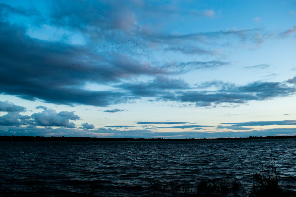
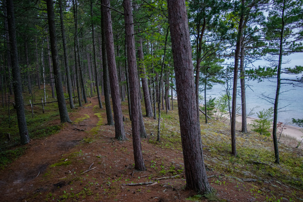
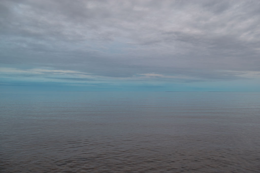
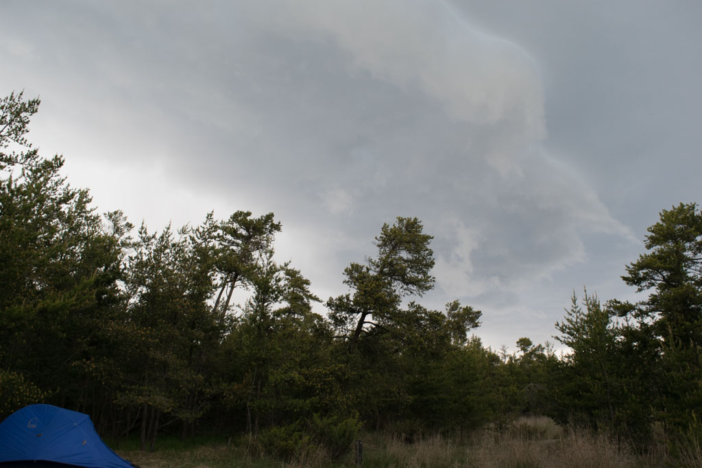
We climbed around a little on the dunes before returning to camp for the night. A huge dune behind our site gave us a clear idea of what lives in the area just by looking at all the hoof and pawprints visible. To see Lake Michigan you had to climb a sheer dune probably about 30 feet high and prepare for sand to get everywhere. Big Sable Lighthouse was probably only about a mile away and you could see it clearly, but walking on the dunes is a very different kind of trail than walking on a path, so we decided to hold off on that journey until morning. That was just as well because from our campsite we had a full 360 view of the scary storm cloud approaching from the west. There was a brief squall and then nothing further.

_DSC0010 (1)

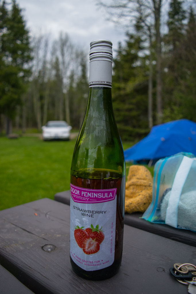
Camping at the Jackpines in many ways felt like visiting the theater. Our spot was nestled between the large dune between us and Lake Michigan, and a smaller dune between us and the inland Hamlin Lake. A small interdunal pond just feet east of our campsite was the setting for the romantic subplot. Once the sun set we heard the croaks of one lonely male frog calling for a mate from our adjacent pond. Later we heard the distinctly different sound of a female frog coming from behind us. Over the course of about an hour we listened to them croak at each other until suddenly they were both coming from the same pond. Frog romance, you guys. The role of the villain was played by Trash Bandit, a sneaky raccoon we should have been better prepared for. Remembering this was our wedding anniversary, we drank a bottle of wine and went to bed.

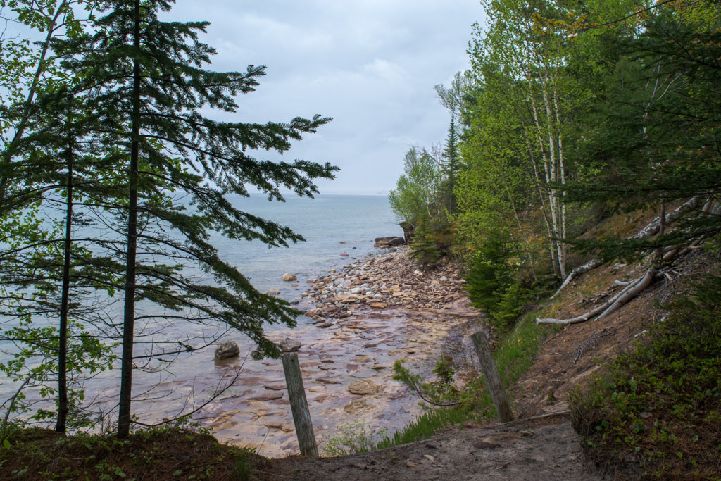
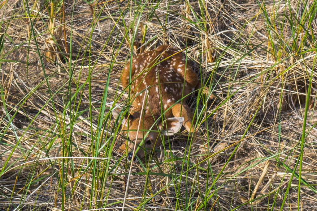
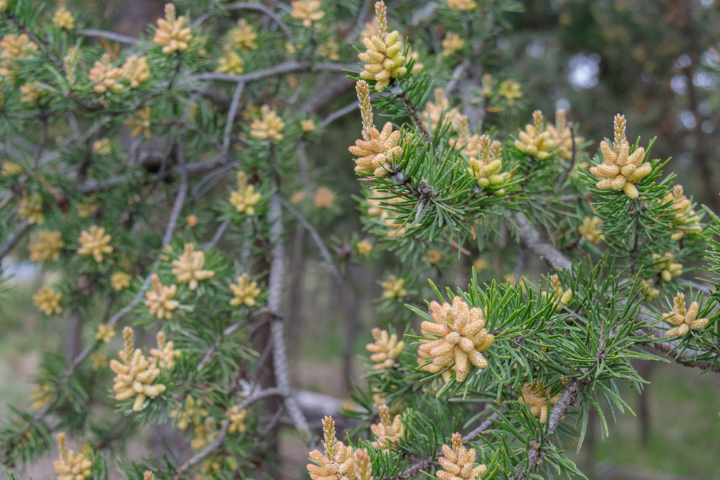
The next morning, before breakfast but after coffee, we hiked up the dunes and then all the way down to Big Sable Lighthouse. It was early and we didn’t see any other people. We did, however, see a white tailed deer bound away from us when we crested a dune. I looked down at where the deer had come from and saw a little spotted fawn crouching still and low among the grasses. Clearly, it was invisible to us and we could not see it at all. (That’s a lie we stood there and aww’d for a while but left alone because it is a wild animal.) We had beautiful skies that morning but the wind was strong and cold. At points walking among the dunes felt more like walking on an alien planet than anywhere in the Midwest.

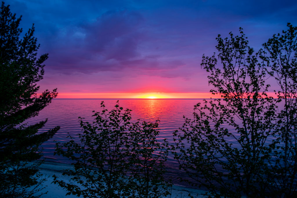
After leaving the Jackpines and Ludington we began the last leg of the drive home. I remember taking a hot shower and sleeping in my own bed but I’ve pretty much just been picturing that sunset I watched from the moss thrones at Sevenmile Creek ever since.

_DSC0182 (1).jpg

[googlemaps https://www.google.com/maps/d/u/0/embed?mid=1P0XG06hXW1-P5of2kUHGmY9TebA&w=640&h=480]

Camp Thunderbird Day 4: Grand Marais, St. Ignace and Cheboygan State Park

Cheboygan State Park
Where we stayed:
Site 48, drive-in, with fire pit, picnic table, Lake Huron adjacent
Good for: Car camping, families, RVs
Not great for: Backpacking, solitude
Pros: Plumbing, clean bathrooms, plentiful drinking water, fire pit, birdwatching, sunsets
Cons: Popular, full of cars and RVs, difficult not to see the other campers from our site
Website
Reservations

Day 4

The Thunderbird thankfully gave us no trouble starting, which I was concerned about following the morning we left Wells State Park. We probably left Pictured Rocks around noon and drove directly to Grand Marais, Michigan. After a solid day hike Dave and I usually try to find a local tavern or diner because at that point any local food is great. Grand Marais gave us the West Bay Diner, a really cute old diner staffed by a friendly young lady who is studying the history of small towns in the rural Great Lakes region (that’s what she told us anyway.) The coffee is hot, the service is slow, the handsoap in the bathroom was plentiful. That is to say, it was exactly what we needed when we needed it.

It’s about a two hour drive from Grand Marais to Cheboygan State Park. This would be the shortest drive of the trip and Cheboygan is not known (apparently) for its outdoor recreation. The handful of people we told our plans to while we were still in the UP said things to us like “Huh, they got camping in Cheboygan?” Yes, folks. They do. Truth be told, there wasn’t too much outstanding about the park itself. We picked Cheboygan for a couple of reasons. Firstly, it wasn’t a long drive from Pictured Rocks and after two nights sleeping rough, I was pretty sure I wouldn’t want to spend a lot of time in the car. Secondly, because it had high tech facilities like running water and flush toilets, which are both nice for comfort reasons and because I wouldn’t have to pump my own drinking water by hand. Lastly, it was on Lake Huron, which would just tick one more of the list of Great Lakes to see on this trip. Every campsite had a picnic table and a solid concrete firepit.

DSC_0794.jpg

This was part of the road trip I was personally looking forward to because we would need to pass through one of the last remaining vibrant vestiges of the mid-century American love affair with the automobile. St. Ignace is one of those towns that popped up as a roadside respite for people on the newly-constructed highway during the postwar boom. The Upper Peninsula of Michigan meets the Mitten at exactly one place, St. Ignace. The only road between the two is via the 5-mile long Mackinac Bridge. It’s an engineering marvel, and it costs $8 to cross. When the bridge opened up in 1957, St. Ignace embraced the flood of new drivers and opened up tchotchke shops, restaurants and tourist traps that are still around today. We paid $1 to climb a clapboard faux lighthouse to get a better view of the suspension bridge and we paid a visit to the Mystery Spot where we were cheated nice and fair. I had a great time and would happily get cheated fair again.

Do you know what a pastie is? (Not that, get your mind out of the gutter.) A pastie is a meat or veggie hand pie and a traditional meal in the UP. We were advised by a local to stop by Suzy’s Pasties on our way through and my only regret is not buying way more pasties from her. There is no eat-in option, she only sells pasties to go. They come in beef, chicken or veggie options and she will sell them to you at temperatures that range from completely frozen to cold. This is the best that roadside America could possibly offer and that is a high compliment. We got a couple of cold beef pasties, wrapped them in tinfoil, and heated them by the campfire in Cheboygan. If I could, I would have divorced Dave and married that hand pie but instead I just ate it and didn’t even need to call an attorney. If you are in St. Ignace and you don’t try to visit Sue’s you are making a terrible mistake.

DSC_0825.jpg

We arrived at Cheboygan State Park fairly late in the day. Which was fine, honestly. It wasn’t a big hiking day but we were both completely exhausted. I set up the tent while Dave built a fire. We did manage to dry out a great deal of our stuff this way. Lake Huron, at least at this particular spot, pales in comparison to Lake Superior or Green Bay for beauty but that’s okay. Our shores were marshy and full of birds and we had a pretty good view of the sunset from near our campsite. A grove of trees kept the wind from being too harsh on our site. We watched huge groups of ducks migrate north for the season while the light faded.

Camp Thunderbird Day 5: Ludington State Park

DSC_0829.jpg

[googlemaps https://www.google.com/maps/d/u/0/embed?mid=1P0XG06hXW1-P5of2kUHGmY9TebA&w=640&h=480]

Camp Thunderbird Day 3: Pictured Rocks National Lakeshore Sevenmile Creek to Au Sable East Campground, Shipwreck Beach and the Log Slide Overlook

Pictured Rocks National Lakeshore
Where we stayed: 
Au Sable East Campground
Good for: Backpacking, solitude, long hikes, backcountry camping, families willing to hike-in
Not great for: Car camping
Pros: Stunning scenery, Shipwreck Beach adjacent, lighthouse adjacent, very quiet, one lonely but clean vault toilet without any walls or roof to shelter it, plentiful fresh water but you have to filter it out of Lake Superior
Cons: Group campfires rather than individual ones, that weird vault toilet
Website
Reservations

Day 3

We woke up around 9 a.m. at Sevenmile Creek and it was immediately apparent we would not have the kind of bright, sunny weather we had seen the day before. That’s fine, we knew what we were getting into when we agreed to this. Today was the big day, it was going to be an 8 mile hike from Sevenmile Creek to the Au Sable East campground. I know 8 miles isn’t that long in the world most serious backpackers occupy (you know the ones, they always seem to be in the middle of thru-hiking the PCT but somehow they can post on Instagram and hike 30 miles a day.) For our first major backpacking trip, I didn’t want to make stupid decisions, so 8 miles with 30 pounds on our backs was already enough.

One of the most amazing things about the Great Lakes is the way they are visibly alive. If you pay attention, they tell you exactly what is going on. Lake Superior had changed overnight from a deep sea of celeste blue and sapphire, to a flat plane of murky cerulean. The new growth on the maple trees in early spring were already dripping from the rain, and would continue to throughout most of the day. We downed a couple of granola bars, packed up camp, and began the hike to the campground east of the Au Sable lighthouse.

_DSC0623-2.jpg

In truth, I’ve always kind of liked the rain in the forest. It feels right. The forest – if you leave it alone – will find its own balance and the rain is a vital part of that. I would have taken more photos that day, but it rained on us fairly steadily throughout the morning and afternoon. At points, especially as we moved further into the woods and away from the lake, the rain on the ferns and moss made it feel as if we were walking through a prehistoric forest. In early spring the forest floor wears shades of muted cedar and pale green and the dampness from the rain covers them in rich tones. When we were near the shore the rainfall really emphasized the power of the streams and creeks that empty into Lake Superior, causing them to swell enough that we just avoided the sandy beaches that day. The rocky beaches east of the lighthouse, however, were stunning.

_DSC0569

We lined our backpacks with contractor garbage bags and stuffed everything inside. They worked pretty well at keeping everything inside the backpack dry, but next time I would bring a waterproof cover for the exterior. I think not having to let everything dry out would really and truly be worth the added weight. After about 5 hours of trudging through the rain with the weight of our packs, and the occasional fits and starts to adjust it, we made it to Au Sable East. We also learned we can set up our entire tent in the rain in about 7 minutes if we really need to. We also both immediately napped for a few hours. You guys, backpacking in the rain is exhausting work.

_DSC0521.jpg

Au Sable East Campground is about a quarter mile east of the Au Sable Lighthouse. The lighthouse is still in active use because it overlooks Au Sable Point, which has since the 19th century been known as the “Shipwreck Coast.” The reef it overlooks extends about one mile into Lake Superior and at points is only about six feet deep with a floor of solid sandstone. As a result, the rocky coast to the east of the lighthouse is dotted with the clear evidence of shipwrecks. When we were there most of the big skeletons had washed away from the year before, but it wasn’t a long walk down the coast before you’ll step over worn down wooden planks or rusted bolts. In the “Wreck of the Edmund Fitzgerald“, Gordon Lightfoot sings “Lake Superior it’s said/ never gives up her dead” and this is true. Because of the great depth and extreme year-round cold temperatures of the lake, the bacteria that would usually cause a body to decompose (and either float to the surface or become a source of food for the underwater wildlife) can’t survive. The Edmund Fitzgerald sank in 1975 and its remains were found in the weeks following its sinking. In 1995 cameras were sent to survey the wreck and crew members were found. Their bodies were still visibly in tact and wearing life vests on the floor of Lake Superior. It speaks to the power of this lake. Since the 1800s, we’ve been doing our best to navigate or tame it. Lake Superior, however, does not care. It will claim you and it will keep you. It may spit up a piece of your ship onto Shipwreck Beach, but it keeps what it keeps. The water along the shoreline is beautiful, crisp and clear.

_DSC0692.jpg

We woke still in the middle of the afternoon, but at this point the skies had largely cleared. It would remain largely overcast for the next few days, but at least the rain had stopped. The sun was out enough that we were able to put up a clothesline and hang stuff to dry. Dave’s stuff didn’t fare as well as mine, and we were basically working on drying his backpack and t-shirts for the next three days.

_DSC0516.jpg

The Au Sable East campground is set about a quarter mile east of the lighthouse, and the path divides space between the group campsite and the individual campsite. We stayed in campsite 12 on the individual side. There are no individual fires allowed in Pictured Rocks but there is a group firepit for the whole camp to share. The night we stayed at Au Sable East there was only one other couple staying there but they, like us, seemed more interested in keeping to themselves. There was a small bench set to the side of the flat space where we put up our tent. If you were willing to walk to it there was a vault toilet, standing free among the pines, with no walls or doors around it. If you’re comfortable using it, it’s probably a very freeing experience.

_DSC0582.jpg

Post-nap, we took a walk back to the lighthouse. On our way through initially, we were both so tired of carrying heavy packs in the rain that we hadn’t taken the time to explore. Now, rested and refreshed, we wandered back in that direction, periodically picking up a rock and throwing it into the lake (one of life’s great joys.) The red and taupe sandstone that makes up the its floor contrasts with the verdant green of the new spring growth and the slate grey shades of the sky and the lake when it’s upset. Staring out from Au Sable Point, the rocky reef is very visible. It makes a great deal of sense why the early explorers needed a lighthouse here.

With no great view of the western sky from Au Sable East, we turned in early. We ate a can of baked beans for inner, which after an exhausting and long day were possibly some of the most transcendent baked beans I’ve ever tasted. I’ll wax philosophic about that another time, but there’s a good chance I was deep into the Forest Madness at this point. After dark, Dave read an H.G. Wells’ story aloud to me until I fell asleep. We may have both been deep into the Forest Madness.

We woke the next morning to blue skies and sunlight streaming through the trees. We lingered a little because it would give our stuff the best chance it had to dry out, and more rain was expected but not right away. The plan was to get back to the car before about noon, which would give us a few hours to putz around camp, walk the beach one more time, refresh our water supply and air out our damp stuff. It was only about 1.5 miles before we would reach the car, but the skies opened up on us once more before we made it. We never got the chance to really see the Log Slide, which is just as well because the lake reclaimed the overlook the winter before. We reached the Thunderbird in a downpour and it felt like crossing a finish line.

Pro tips:

Keep your car keys in a handy pocket so you don’t have to dig forever in the rain when you get to your car.
Keep a new set of fresh, dry clothes in the car so when you get back you can begin to feel like a new person quickly.
Find the water bottle you forgot you’d filled with extra delicious well water from two campsites ago.

Go to Camp Thunderbird Day 4: Grand Marais, St. Ignace and Cheboygan State Park

[googlemaps https://www.google.com/maps/d/u/0/embed?mid=1P0XG06hXW1-P5of2kUHGmY9TebA&w=640&h=480]

Camp Thunderbird Day 2: Pictured Rocks National Lakeshore Twelvemile to Sevenmile Creek

Pictured Rocks National Lakeshore
Where we stayed: 
Sevenmile Creek Campsite, we reserved site 10 but the campground was overbooked and none were available by the time we got there. We went rogue and stayed on an unsanctioned spot adjacent to Lake Superior.
Good for: Backpacking, solitude, long hikes, backcountry camping
Not great for: Families, car camping
Pros: Stunning scenery, excellent sunsets, very quiet, plentiful fresh water but you have to filter it out of Lake Superior
Cons: Overbooked campsite, group campfires rather than individual ones
Website
Reservations

Day 2

My eyes flashed periodically to the clock in my car as I tried not to careen too recklessly down the gravel roads leading to Pictured Rocks National Lakeshore. Dawdling while breaking down camp and a short visit with one of Michigan’s finest had left us in very real danger of missing our appointment with Altran, the public transit shuttle service that operated within the park.

We were probably 15 minutes late when we pulled into the parking lot for the Log Slide Overlook. Our driver was leaning against the bus, and nearing the end of his cigarette. If I know one thing about smokers, it’s that they’re super good at wasting time. I would bet an iron lung that cigarette saved our butts that day.

We had really only enough time to throw our bags into the van before the driver needed to get on the road. We were the only passengers he had that day, but he’s a retiree, he said, and when he’s done he gets to go home to that six pack he’s been working on. I, obviously, loved our shuttle driver.

It’s almost a 14 mile drive from the Log Slide Overlook to Twelvemile Creek, where we’d begin our hike for the day. From there, the plan was to walk to Sevenmile Creek and camp there for the night. It would be about a 4 mile walk from Twelvemile Creek to Sevenmile Creek, (don’t let the math fool you.) I thought this would be a good one because this was our first real night unsupported in the woods, I didn’t want to also have to walk ten miles or more in case for one reason or another this turned into a terrible idea (spoiler: this was a great idea.)

_DSC0315.jpg

The weather was gorgeous that day, it was almost certainly the most sunshine we would see the whole trip. Considering how quickly the weather can turn on Lake Superior, this was a blessing. The trail is situated at the top of the dunes, probably 150-feet or so above the lake and the beach. I had seen Lake Superior when I was a kid, but this was my first time seeing it as an adult. I was stunned by how clear the water is. Lake Superior is so large and so clear that you can see an average of 27 feet deep throughout. It’s so large you can stare at the horizon all day but you’ll probably never see the other side (which is Canada from where we were standing.)

It was probably around 5 p.m. by the time we got to Sevenmile’s official campsite. This was Memorial Day weekend, so the campsite was full. We had reservations, which told us to look for campsite 10. We began asking around and learned we were not the only ones who thought we had booked campsite 10. Be aware, there may or may not be a campsite 10, but no matter what it was clear the campground was overbooked and Dave and I would need to find a place to lay down for the night outside of authorized spots. Honestly, we did okay. We wandered maybe 300 feet away from the main campsite and found a flat spot on an unauthorized trail, just above another unauthorized trail leading down to the beach. It had a large berm to our back, which helped protect us from the cold air off Lake Superior, and we could see the designated campfire through the trees but weren’t close enough to be bothered by it. We tried our best to set up camp so as not to be in anyone’s path, and most people were considerate enough to give a wide berth. So it worked out. We set up camp, grabbed our hand pump water filter and water bladders, and walked down to Sevenmile Creek itself. Dave and I took turns filtering probably a total of 12 liters of water by hand. Two 3-liter bladders for drinking and one 6-liter bladder for camp use (cleaning your dishes, teeth.)

The flora and fauna creekside were very charming.

_DSC0214.jpg

Once the camp chores were complete, I wandered off down the path just to see what I could see. I didn’t plan to be gone long, but I got distracted down the path. The view from on top of the berm was just stunning and I was having a bit of a love affair with the way these huge pines grow out of such sandy dirt and out of a dune that could very well wash away next year. Dave found me and became enamored with the mosses growing on the trees, but he’s got a thing for lichen.

_DSC0317.jpg

After wandering back to the campsite we descended to the beach. Because we were camping at the spot where Sevenmile Creek empties into Lake Superior, I first put my hand into the creek water and thought “Oh, yeah. That is cold.” Then I put a finger into Lake Superior and pulled it out immediately because oh my god no. The lake was at least 15 degrees colder than the creek. To be fair, Lake Superior still had ice on it about a week before we got there. The Great Lakes are amazing, you guys.

After walking around the beach and skipping rocks for a while we made our way back up to the campsite. Pictured Rocks has those really great, long Northern sunsets that last an hour or more and when you think it’s done suddenly there is a magnificent flash of vibrant red light before darkness comes quickly thereafter. This was possibly the longest, most beautiful sunset I had ever seen. Dave and I camped out to watch it on a patch of moss growing out of the dunes. They looked like they’d been worn down by previous butts watching the same sunsets. These were our moss thrones and they allowed us to survey the beach below, and the powerful lake in front of us. We finished off a small box of warm white wine from our moss thrones. I loved it very much and would happily return again any time.

Once the sun sets this far north there is no lingering light. We quickly made dinner and before we’d finished it we were sitting in complete darkness. We went to bed.

DSC_0469.jpg

Go to Camp Thunderbird Day 3: Pictured Rocks National Lakeshore Sevenmile Creek to Au Sable East Campground, Shipwreck Beach and the Log Slide Overlook

[googlemaps https://www.google.com/maps/d/u/0/embed?mid=1P0XG06hXW1-P5of2kUHGmY9TebA&w=640&h=480]

Camp Thunderbird Day 1: Chicago to Wells State Park

J.W. Wells State Park
Where we stayed: 
Site 152, rustic, no electricity, drive-in, with a gorgeous view of Green Bay, sunny in the morning
Good for: Families, couples, RVs, car camping, cabins
Not great for: Backpacking, solitude
Pros: Views, campfires, great tasting water, clean vault toilet
Cons: Sites can be close together, which is only a bother if your neighbors are noisy
Website
Reservations

Day 1

The first leg of the trip took us from our apartment in Chicago to Wells State Park, in Michigan, just barely in the Upper Peninsula. The major purpose in planning this whole trip was to get some real unsupported backpacking experience, where we walk away from our car and we’re obligated by circumstance to care for ourselves. Neither of us had ever been to Pictured Rocks National Lakeshore, but it was only an 8 hour drive, it looked gorgeous and that early in the season it was unlikely to be overrun by other campers and hikers.

So, the thought process went, as long as it was going to be an 8 hour drive up I-43 then up further still to the top of the Upper Peninsula, we might as well break it into two days. Then, as long as we’re going to the top of the UP, we might as well come down the other side since it wouldn’t take more than a few hours longer and it sounded like fun. Maybe take an extra day or two in the mitten and meander your way back home. Ipso facto – that’s how you plan a Circle Tour.

_DSC0069.jpg

So over five days we planned to camp all over Michigan including:

  • Wells State Park, Site 152, facing Green Bay, water pump adjacent
  • Pictured Rocks National Lakeshore, Sevenmile Creek campground
  • Pictured Rocks National Lakeshore, Au Sable East campground
  • Cheboygan State Park, Site 48, adjacent to Lake Huron
  • Ludington State Park, Jackpines Site J

We took off from our apartment in Logan Square around 10 a.m. Friday morning. We planned to take a fairly leisurely drive north up to Wells. We did stop for provisions of cheese, beer, wine and sausage at the venerable Mars Cheese Castle. We had lunch at some tavern near Kohler, Wisconsin and we probably arrived at Wells around 6 p.m. with two and a half hours of daylight to burn.

_DSC0029.jpg

The whole journey was a mix of car camping and backpacking and I think that was a great way for a couple of noobs to get acclimated. The campsite at Wells State Park had a sizable fire pit, Green Bay’s waters were smooth as glass that day, we were unable to see another soul from our site, the vault toilets were quite clean and drinking water was plentiful and easily available from the adjacent water pump. We put our tent down on a flat piece of grass probably only 20 feet from the lake.

Wells State Park was a make work camp created by the Civilian Conservation Corps during the Roosevelt administration, and you can still book one of the cabins they built if you so choose. The hand pump was very likely installed by the same team way back then. Last May when we were there it was simply covered with midges but if you’re not grossed out by that it’s fine. The water did not directly encounter any wildlife as it made its way from the pipe to my nalgene, so I wasn’t bothered. One thing I will say for the water at Wells State Park is that it tastes absolutely delicious. I grew up with well water, it tastes great to me. This particular well had a crisp mineral-y taste. I made sure to refill my bottle once more before we left in the morning and then I forgot about it until after we came back at the end of the Pictured Rocks leg of the excursion. Which was an excellent surprise that I left for me.

The first thing we did was set up camp. I assembled the tent while Dave built the fire. We had picked up a bottle of one of Wisconsin’s freshest strawberry wines at the Mars Cheese Castle. After the tent was assembled we tied one end of the string to the neck of the bottle and the other end to a rock. We then placed the bottle end into Green Bay and I wandered off to take pictures.

_DSC0088

The skies were overcast that day, but the temperatures were warm enough and we weren’t in danger of any rain. The lake looked like an upside down version of Sky above Clouds IV by Georgia O’Keefe. Nature is amazing, you guys. I think at one point I probably sat on a rock in the lake near the shore, just staring at birds for the better part of an hour. Dave created firewood out of downed trees with a pocket saw. Before the sun set we pulled the lukewarm wine out of the lake and drank it from our cups. Why tin cups? Because camping is fun, that’s why.

I woke up early to see the sunrise the next morning. Having snapped a photo, I returned to the tent and snoozed until it was a more decent hour. That was probably a dumb idea, but whatever. We packed up camp, made coffee, assembled our backpacks so we wouldn’t have to do any additional futzing when we got to Pictured Rocks, cleaned our campsite, turned the keys in the ignition and … nothing happened.

The Thunderbird is a 23-year-old, reliable beast of a machine. I’d recently taken it for major maintenance including new tires, brakes, wheel balance and a whole bunch of fluid refreshers. The battery and the starter were both new. What the hell? A nice couple of retirees towing an RV behind their dually was kind enough to give us a jump. Once a pair of cables were attached to the battery it was pretty clear it wasn’t dead, it just needed help getting started. Either way, I had a 2 p.m. appointment at Twelvemile Creek (two and a half hours away) with a public shuttle service in Pictured Rocks, making this a problem for later. The car now in motion, we sped out of the park and were promptly pulled over by the Michigan State Police. Did I know the truck in front of me with the Illinois plates, he asked? No sir, I do not know that person. Okay here’s your voucher, get on your way, ma’am. Thank you, officer.

We were now in real danger of missing our appointment with Altran, the public shuttle service that operates within Pictured Rocks. Ensuring that I stayed within the legal limit for speeding, I engaged all eight cylinders and headed north across the Upper Peninsula of Michigan.

Click here for Day 2: Pictured Rocks National Lakeshore Twelvemile to Sevenmile Creek

[googlemaps https://www.google.com/maps/d/u/0/embed?mid=1P0XG06hXW1-P5of2kUHGmY9TebA&w=640&h=480]


Gear review: Coleman Max 2L hydration day pack


This pack was purchased by Third Coast Hikes and this review is my own.

Yesterday, the weather was a stunner. We headed out to our favorite day hike spot within about an hour’s drive of our place in Chicago. Gander Mountain Forest Preserve up near Fox Lake, Illinois and directly on the Wisconsin border is easily the best spot for an afternoon of challenging hiking, when you can’t get far from Chicago.

When we’re just going on a one day hike we limit ourselves to the Coleman Max 2L hydration day packs we bought probably three years ago for our trip to the Grand Canyon. We probably paid about $25 for them at the time, and that was at least three years ago, so I’m having trouble finding our exact model online. This is similar, sorta.

The primary reason we chose them was because we wanted to carry water with us through the arid canyon environment, and it totally worked for that. The packs came with a 2L bladder, we have since upgraded to a 3L bladder, and the hose mechanism never stuck too bad. It could have been more antimicrobal than it was, but because we have replaced the bladders that doesn’t matter anymore.

There’s a good amount of space inside, but because I tend to fill my pack with ice and water, if I don’t want something to get cold or risk it coming in contact with condensation, I put it in the front pocket. It’s got zippers on two sides, which are fine but I don’t totally get. There is a mesh inner-inner pocket so that’s a good place for keys and things you really don’t want to lose. There are also these two triangle pockets on the front which I do not understand. Why are they there? I’ve managed to attach a bike helmet between those, but I’m really not sure what’s going on with that.

After a few years of wear, they aren’t in great condition anymore. They still work, this year they accompanied us to Riot Fest for the last few years. The zipper on mine is starting to split, so it’s probably nearing the end of its lifespan. Until there is a compelling reason to replace it, I probably won’t.

A middling review for a middling product. S’alright, not bad, not great. C+